




Introduction to Soil Erosion
Soil erosion involves the movement of soil particles by natural forces.
For property work, this movement can change ground surfaces over time.
Early attention reduces future repair and maintenance needs for properties.
Why Soil Condition Matters in Development
Stable soil supports structures and landscaping during construction and use.
Consequently, erosion can alter load-bearing characteristics of the ground.
Therefore, developers must consider soil movement early in planning phases.
Key Factors That Influence Erosion
- Water flow from rain and runoff can displace surface soil.
- Slope steepness influences how quickly soil moves downhill.
- Vegetation cover helps hold soil in place on slopes.
- Ground disturbance from construction exposes soil to movement.
Drainage Considerations and Planning Benefits
Effective drainage directs water away from vulnerable areas on a site.
Additionally, poor drainage can exacerbate soil movement and surface runoff.
Moreover, planning promotes long-term site stability and predictable outcomes.
This introduction previews practical strategies for erosion control and drainage.
Furthermore, upcoming sections will discuss planning and design considerations.
Factors Contributing to Soil Erosion
This section analyzes the primary factors that drive soil erosion.
Additionally, it breaks those factors into physical, hydrological, biological, and human categories.
Moreover, it supports targeted management of erosion drivers.
Soil Characteristics
Soil texture affects how particles detach and move.
Transform Your Agribusiness
Unlock your farm's potential with expert advice tailored to your needs. Get actionable steps that drive real results.
Get StartedFurthermore, soil structure influences resistance to erosive forces.
Organic matter increases cohesion and improves soil stability.
Similarly, soil permeability controls infiltration versus surface runoff.
Topography and Slope
Slope gradient increases the speed of surface water flow.
Additionally, slope length affects the volume of accumulated runoff.
Aspect can change moisture and vegetation patterns on slopes.
Hydrological Factors
Rainfall intensity determines detachment potential of surface particles.
Runoff volume controls the transport capacity for eroded material.
Infiltration rate moderates how much water becomes surface flow.
Surface flow concentration creates channels that deepen into rills and gullies.
Vegetation and Ground Cover
Vegetation roots bind soil and reduce detachment.
Canopy cover intercepts rainfall and lowers impact energy.
Ground cover reduces surface flow velocity and traps sediment.
Vegetation removal exposes soil to direct erosive forces.
Human Activities and Land Use
Earthmoving and grading disturb soil structure and expose soils.
Soil compaction reduces infiltration and increases runoff rates.
Impervious surfaces increase runoff intensity and peak flows.
Poorly timed or absent erosion controls leave disturbed soil vulnerable.
Drainage and Water Management
Inadequate drainage concentrates flow and accelerates erosion.
Poorly designed conveyance channels cause local scour and instability.
Blocked or undersized drains cause surface ponding and overflow.
Interactions and Cumulative Effects
Multiple factors often act together to amplify erosion risk.
For example, slope and heavy runoff increase detachment and transport.
Therefore, assessing combined effects offers a clearer risk picture.
Showcase Your Farming Business
Publish your professional farming services profile on our blog for a one-time fee of $200 and reach a dedicated audience of farmers and agribusiness owners.
Publish Your ProfileIndicators and Early Warning Signs
Surface rills indicate active erosion processes on slopes.
Gully formation signals concentrated flow and advanced erosion.
Exposed roots and sediment deposits warn of ongoing soil loss.
Ponding and unexpected drainage points reveal impaired runoff paths.
Managing the Factors
Site assessment should identify the dominant erosion drivers for each area.
Prioritizing preventive measures addresses the most significant factors first.
Finally, monitoring indicators helps adapt management as conditions change.
Differentiating Erosion Types
This section explains common erosion forms relevant to property development.
It focuses on rill, sheet, and gully erosion distinctions.
Additionally, it outlines visible signs and management considerations for each type.
Rill Erosion
Rill erosion appears as small, narrow channels on the soil surface.
These channels often become noticeable after surface runoff events.
They can interfere with grading and surface stability on sites.
Visible Signs
Detection requires close surface observation during and after events.
- Multiple fine channels converge downhill.
- Soil between channels remains largely intact.
Management Considerations
Prompt identification helps prevent progression to larger erosion forms.
Moreover, site planning should address concentrated surface flows.
Sheet Erosion
Sheet erosion removes a thin, uniform layer of soil across slopes.
It often lacks obvious channel features for quick detection.
Seedlings and fine materials wash away uniformly.
Gully Erosion
Gully erosion forms deep, wide channels that resist simple smoothing.
Developments can show visible landscape scars from this erosion.
Concentrated flows deepen and widen these channels over time.
Key Differences and Field Indicators
Rill, sheet, and gully erosion differ in scale and visible form.
Detection methods vary according to erosion type and site conditions.
Field indicators help determine appropriate management responses.
- Rills indicate small concentrated flows over short distances.
- Sheet erosion suggests broad surface removal without channels.
- Gullies reflect persistent, concentrated flow that forms large channels.
Implications for Property Development
Understanding erosion types aids appropriate site assessment and planning.
Therefore, teams should document observed erosion features early in projects.
Early mapping and stabilization support project planning for problematic areas.
Uncover the Details: The Role of Crop Adaptation in Sustainable Farmland Ownership
Importance of Drainage
Proper drainage protects built structures from excess water.
It also helps maintain usable outdoor spaces after storms.
Consequently, effective drainage lowers long term repair needs for property elements.
Why Drainage Matters
Drainage prevents water from accumulating near foundations.
Proper systems preserve landscape usability and outdoor function.
They also reduce the risk of long term soil instability.
Key Drainage Considerations
Several factors guide drainage design on a site.
Consider topography, soil permeability, building integration, and maintenance needs.
Assessing these aspects helps determine surface or subsurface solutions.
Site Topography and Flow Paths
Topography defines direction and speed of surface runoff.
Mapping flow paths informs drainage placement and sizing.
Showcase Your Farming Business
Publish your professional farming services profile on our blog for a one-time fee of $200 and reach a dedicated audience of farmers and agribusiness owners.
Publish Your ProfileTherefore, planners should evaluate slopes when locating drains.
Soil Permeability and Infiltration
Soil permeability affects how water soaks into the ground.
Permeability therefore influences the need for surface versus subsurface drainage.
Testing infiltration rates helps decide appropriate drainage methods.
Integration with Building Design
Designers must coordinate drainage with foundations and landscaping features.
Coordination prevents water from undermining structures or creating wet areas.
Early collaboration reduces the likelihood of costly repairs.
Maintenance and Durability
Drainage systems require regular inspection and upkeep to function properly.
Accessible designs simplify long term maintenance tasks.
Routine upkeep extends system durability and performance.
Benefits of Effective Drainage
Effective drainage preserves soil and reduces soil loss.
It helps keep outdoor areas usable after storms.
Additionally, it aids infrastructure resilience and performance.
- It reduces erosion and preserves topsoil stability.
- It improves site usability after heavy rain events.
- It supports longevity of pavements and foundations.
- It aids in flood risk management on developed sites.
Planning Approach
Assess existing water movement across the site early in planning.
Then align drainage choices with intended land uses and structures.
Finally, design systems that remain serviceable and adaptable over time.
Learn More: Erosion Risks and Land Stability Considerations for Real Estate Buyers
Assessing Erosion Potential on Development Sites
Use a structured approach to assess erosion potential.
Combine desktop research with field observations.
Document results to guide planning and temporary controls.
Preliminary Desktop Assessment
Begin with a desktop review of existing site information and maps.
Next, analyze historical imagery to note visible landscape changes over time.
Additionally, gather previous survey reports and geotechnical summaries when available.
Field Reconnaissance and Visual Indicators
Conduct a systematic walkover to observe surface conditions and drainage features.
Observe areas with exposed soil, sediment accumulation, and active surface flow paths.
Moreover, document locations that show concentrated runoff or channel formation.
Soil and Vegetation Characterization
Sample soils to evaluate texture, structure, and permeability characteristics.
Additionally, describe plant cover, root density, and vegetative continuity across the site.
Also, record signs of compaction or disturbances from past land use.
Slope and Drainage Pattern Mapping
Measure slope gradients and aspects across proposed development areas.
Next, map existing drainage patterns and potential flow accumulation zones.
Use transects or grid surveys to ensure systematic spatial coverage.
Hydrologic Assessment and Erosion Potential Evaluation
Estimate relative runoff generation using rainfall and surface conditions information.
Additionally, assess how peak flows might concentrate along existing channels and slopes.
Then, rank site sections by their relative susceptibility to erosion for planning focus.
Prioritizing Investigations and Monitoring
Identify high priority zones for detailed testing.
Mark areas needing ongoing monitoring during construction.
Set simple performance indicators to track erosion across project phases.
Reporting and Recommendations
Compile findings into a clear report.
Highlight key risks and uncertain areas in that report.
Showcase Your Farming Business
Publish your professional farming services profile on our blog for a one-time fee of $200 and reach a dedicated audience of farmers and agribusiness owners.
Publish Your ProfileRecommend targeted investigations or temporary controls where risk appears higher.
Find Out More: How Soil Health Impacts Property Value in Rural and Urban Areas
Preventative Measures for Soil Erosion during Construction
This section outlines practical measures to prevent erosion during construction.
It focuses on on-site actions contractors and developers can implement.
Practical steps aim to reduce soil loss during construction activities.
Planning and Site Management
Plan construction to minimize the area of exposed soil at any time.
Additionally, phase work to reduce simultaneous disturbance across multiple areas.
Also, designate and enforce equipment access routes to limit soil compaction.
Furthermore, protect natural buffer strips along waterways to limit sediment transport.
- Keep disturbance footprints as small as practicable.
- Establish protected buffer strips near drainage features.
- Restrict vehicle movement to defined tracks or pads.
- Schedule grading during dry weather when feasible.
Temporary Stabilization Techniques
Apply temporary vegetation to hold soil on exposed slopes and fills.
Additionally, use mulch or similar coverings to protect bare soil surfaces.
Moreover, employ erosion control mats on steep or highly erodible areas.
- Install seed and mulch shortly after disturbance.
- Use erosion blankets where seeding is impractical.
- Revegetate disturbed areas as soon as site conditions allow.
Sediment Control Practices
Install perimeter sediment barriers to trap dislodged soil before it leaves site.
Additionally, provide sediment collection features at low points and outlets.
Moreover, maintain all sediment controls until final stabilization occurs.
- Place temporary barriers along downhill edges of work zones.
- Construct sediment traps where water concentrates on site.
- Clean and repair barriers after storm events or damage.
Stormwater and Drainage Controls
Divert runoff away from active work areas to reduce erosive flows.
Additionally, protect inlets and conveyances from sediment clogging.
Furthermore, design temporary drainage paths to minimize flow velocity.
- Construct temporary swales to direct stormwater safely.
- Provide inlet protection to prevent sediment entry into drains.
- Ensure outlets discharge to stable non-erodible surfaces.
Maintenance and Monitoring
Conduct regular inspections of erosion and sediment controls during construction.
Moreover, repair or replace damaged controls promptly after detection.
Also, document inspections and corrective actions for ongoing management.
Finally, train site personnel on erosion prevention and control responsibilities.
Implementation Checklist
Define limits of disturbance before work begins.
Install perimeter controls prior to grading.
Stabilize exposed soils daily or after operations cease.
- Define limits of disturbance before work begins.
- Install perimeter controls prior to grading.
- Stabilize exposed soils daily or after operations cease.
- Inspect controls after rainfall and weekly at minimum.
- Maintain clear records of maintenance and observations.
Uncover the Details: Sustainable Farmland Practices to Mitigate Climate Impact
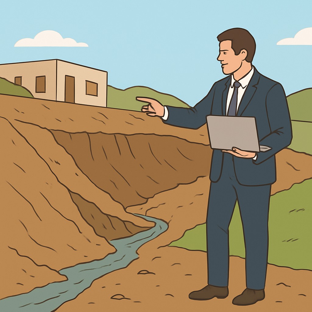
Best Practices for Managing Drainage in Newly Developed Properties
This guide lists best practices for managing drainage on newly developed properties.
It covers site planning, surface and subsurface drainage, vegetation, and stormwater features.
Read the following sections for practical actions and routine maintenance steps.
Site Planning and Grading
Plan grading to direct water away from structures.
Next, create gentle slopes to reduce concentrated runoff.
Also, preserve existing low points that convey natural flow.
Surface Drainage Design
Prioritize permeable surfaces to reduce surface runoff.
Additionally, align paved areas with overland drainage paths.
Install appropriately sized gutters and downspouts on buildings.
Subsurface Drainage Solutions
Assess the need for subsoil drains in poorly draining areas.
Install perforated piping in trenches to collect excess groundwater.
Also, provide stable outlets to prevent erosion at discharge points.
Vegetation and Landscaping
Establish vegetation to stabilize soil and slow runoff.
Select plants suited to site conditions and maintenance capacities.
Showcase Your Farming Business
Publish your professional farming services profile on our blog for a one-time fee of $200 and reach a dedicated audience of farmers and agribusiness owners.
Publish Your ProfileUse mulches and groundcovers to protect exposed soil surfaces.
Integrating Stormwater Management Features
Incorporate basins or rain gardens to manage peak storm flows.
Design such features to retain water temporarily and release it slowly.
Additionally, use infiltration zones to promote groundwater recharge where appropriate.
Routine Maintenance Checklist
Use a checklist to guide routine drainage maintenance tasks.
Focus inspections after major rain events and seasonal changes.
Record completed tasks and findings in a maintenance log.
- Inspect gutters and downspouts after major rain events.
- Remove debris from inlets and surface channels promptly.
- Check grading for signs of settling or unexpected pooling.
- Maintain vegetation and replace bare patches quickly.
- Verify outlet integrity and stabilize any eroding edges.
Coordination and Documentation
Document drainage layouts and materials for future reference.
Assign clear maintenance responsibilities to property managers or owners.
Finally, review drainage performance periodically and update plans accordingly.
Real-World Applications and Examples
This section presents anonymized examples from property development.
Examples emphasize practical site measures and coordination.
They illustrate how teams addressed erosion control and drainage.
Overview of Case Study Types
The following anonymized examples illustrate typical approaches taken in property development projects.
They focus on practical integration of erosion control and drainage.
Examples include residential hillside projects, commercial site redevelopments, subdivision grading sequences, and landscape-led stabilization.
- Residential hillside projects
- Commercial site redevelopments
- Subdivision grading sequences
- Landscape-led stabilization
Site Preparation Example
Project teams phased earthworks to minimize exposed soil during grading.
They used temporary stabilization to protect disturbed areas.
This approach limited the duration of bare soil on site.
Landscape Integration Example
Designers incorporated native vegetation to establish long-term soil stability.
Planting schemes complemented engineered slope treatments and drainage features.
Vegetation supported durable stabilization when paired with engineered controls.
Drainage Coordination Example
Teams coordinated surface drainage routing with erosion control measures early in planning.
Runoff reached treatment zones before leaving the property.
Early routing ensured controls treated flows effectively.
Monitoring and Adaptive Management Example
Stakeholders scheduled recurring inspections throughout construction and post-development phases.
They adapted controls based on observations and changing site conditions.
Routine reviews enabled timely adjustments to erosion measures.
Lessons Learned and Transferable Strategies
Early coordination among design, construction, and landscaping teams proved essential.
Combining temporary and permanent measures often improved site resilience.
Clear maintenance responsibilities supported long term performance of controls.
- Prioritize early planning and team coordination
- Use phased work to limit soil exposure
- Integrate vegetation with structural measures
- Implement routine monitoring and adaptive responses
Future Directions for Soil and Drainage Management
Future directions prioritize resilient soil and drainage strategies for long term site performance.
Municipal planners, developers, and engineers must coordinate early on project timelines.
This section outlines planning, adaptive management, resilient design, stakeholder collaboration, and research pathways.
Planning and Policy Integration
Planners should incorporate soil and drainage considerations into local development plans.
Early coordination between developers and regulators reduces regulatory delays and design conflicts.
Land use policies can incentivize long term site resilience and maintenance commitments.
Adaptive Management and Monitoring
Implement adaptive management frameworks to adjust strategies as site conditions change.
Routine monitoring provides data for timely adjustments to drainage and erosion controls.
Project teams should respond quickly to observed soil movement or altered water flows.
Showcase Your Farming Business
Publish your professional farming services profile on our blog for a one-time fee of $200 and reach a dedicated audience of farmers and agribusiness owners.
Publish Your ProfileDesigning for Resilience
Designers should prioritize flexibility and redundancy in drainage systems.
Use accessible features to ensure long term maintainability of drainage elements.
Additionally, combine soft and engineered measures to enhance resilience under uncertainty.
- Protect natural drainage corridors whenever feasible.
- Use layered approaches to manage runoff and erosion.
- Ensure maintainability through accessible design features.
Stakeholder Collaboration and Capacity Building
Engage local stakeholders early and maintain consistent communication.
Provide training programs that build long term operational skills for site teams.
Shared responsibility improves site performance and encourages timely maintenance.
Operational Maintenance and Long-Term Stewardship
Property owners must plan and budget for ongoing maintenance activities.
Schedule regular inspections to detect early signs of erosion or blockage.
Timely maintenance preserves system function and reduces long term costs.
Pathways for Research and Innovation
Researchers should explore scalable approaches that address urban constraints.
Multidisciplinary studies can connect soil science with development practice and policy.
Practitioners must share lessons learned to refine common approaches over time.