Introduction
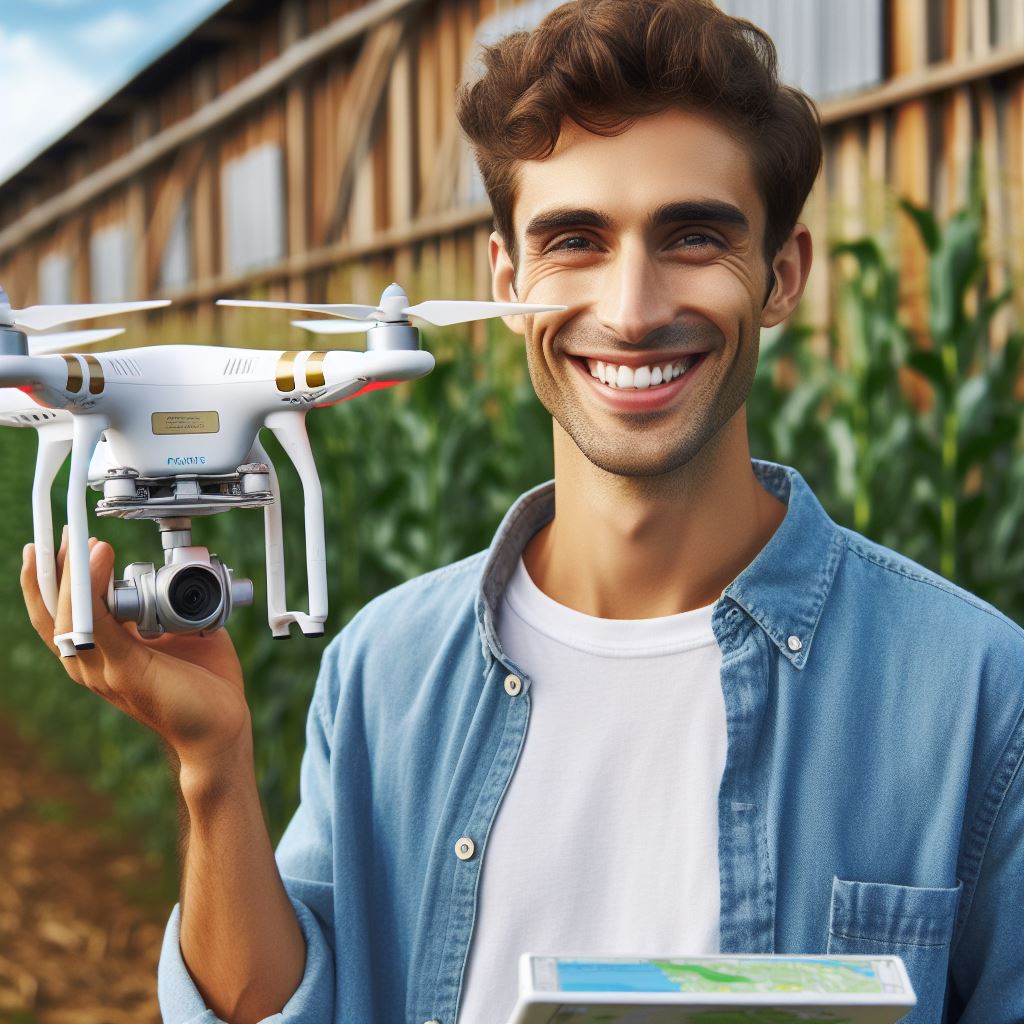
Agri drones have emerged as an innovative solution in the field of agriculture.
These unmanned aerial vehicles offer a range of capabilities that can greatly benefit farmers and contribute to climate resilience.
One of the key reasons why climate resilience is so important in agriculture is the increasing unpredictability of weather patterns.
With extreme events like droughts, floods, and heatwaves becoming more frequent, farmers need tools to adapt and mitigate the impact on their crops.
Agri drones can play a significant role in this regard.
Agri drones are equipped with various sensors and imaging technologies that enable them to collect valuable data from the field.
For example, thermal cameras can detect temperature variations, allowing farmers to identify areas of potential water stress or pest infestations.
Multispectral cameras can capture images in different wavelengths, revealing crop health, chlorophyll levels, or nutrient deficiencies.
This data helps farmers make informed decisions about irrigation, fertilization, and pest control, ultimately increasing crop productivity and resilience to climate change.
Furthermore, agri drones can create detailed aerial maps of the farmland, helping farmers monitor soil conditions, water availability, and crop growth.
These maps provide crucial information for planning and optimizing agricultural practices, such as determining the most suitable areas for planting different crops or identifying drainage issues that can lead to waterlogging.
In fact, agri drones offer a powerful tool for mapping and monitoring in agriculture, contributing to climate resilience.
By providing valuable data and insights, these drones enable farmers to make informed decisions and adapt to changing weather patterns, ensuring the sustainability and productivity of their crops.
Understanding Agri Drones
Definition and basic functionality of agri drones
- Agri drones, also known as agricultural drones, are unmanned aerial vehicles used in farming.
- These drones are equipped with various sensors, cameras, and other technology to collect data and perform tasks.
- They can be operated remotely, providing farmers with a bird’s-eye view of their crops and land.
- The basic functionality of agri drones includes mapping, spraying, monitoring, and data collection.
Different types and capabilities of agri drones
- There are several types of agri drones, ranging from small quadcopters to large fixed-wing drones.
- Quadcopters are versatile and can hover in one place, making them ideal for close-range mapping and monitoring.
- Fixed-wing drones are more efficient and cover larger areas, making them suitable for crop spraying and surveillance.
- Agri drones can be equipped with multispectral cameras, infrared sensors, and LiDAR systems to collect data.
- These drones can capture high-resolution images, monitor crop health, and detect irrigation issues.
Benefits of using agri drones in agriculture
- Agri drones offer numerous benefits to farmers, helping them improve productivity and make informed decisions.
- With the help of drones, farmers can quickly assess crop conditions, identify disease outbreaks, and target specific areas for treatment.
- Agri drones provide accurate and real-time data, allowing farmers to optimize water and fertilizer use.
- They can create detailed field maps, enabling farmers to understand crop variability and plan accordingly.
- Using agri drones reduces the need for manual labor and minimizes human error in data collection and analysis.
- These drones also reduce the environmental impact of farming by enabling precise application of chemicals.
- Agri drones can cover large areas in a short time, saving farmers valuable time and resources.
- They can even help in disaster management by assessing damage after natural disasters and guiding relief efforts.
In short, agri drones provide farmers with a powerful tool to improve agricultural practices.
With their ability to map, monitor, and collect data, these drones enable farmers to make informed decisions, optimize resources, and enhance productivity.
By utilizing agri drones, farmers can embrace climate resilience and mitigate the challenges posed by changing environmental conditions.
Read: Hydroponics: Future of Climate-Smart Ag
Mapping for Climate Resilience
Mapping for climate resilience plays a crucial role in ensuring the sustainability and productivity of agricultural systems.
Accurate and detailed mapping enables farmers to make informed decisions, optimize resource management, and adapt to the challenges posed by a changing climate.
The significance of accurate mapping in agriculture
One of the key reasons accurate mapping is significant in agriculture is its ability to help farmers identify patterns and make informed decisions.
By mapping their fields, farmers can easily spot variations in crop health, soil moisture, and other factors affecting productivity.
This information allows them to take targeted actions, such as adjusting irrigation levels or applying fertilizers only where necessary, ultimately leading to better yields and resource efficiency.
Agri drones, equipped with advanced mapping techniques, play a crucial role in capturing accurate and up-to-date data.
Remote sensing, one of the techniques used by these drones, involves capturing high-resolution images of agricultural areas.
These images provide valuable insights into crop health, identifying stress areas, and detecting early signs of pests and diseases.
By analyzing this data, farmers can intervene promptly and prevent potential crop losses.
Moreover, remote sensing data can also monitor changes in land use, leading to better planning and management of agricultural landscapes.
Mapping techniques used by agri drones
Another mapping technique utilized by agri drones is Geographic Information System (GIS).
GIS allows for the integration and analysis of multiple data layers, creating accurate maps and visualizations.
By combining information such as soil type, topography, and weather patterns, farmers gain a comprehensive understanding of their agricultural landscapes.
This knowledge aids in better decision-making regarding crop selection, planting strategies, and resource allocation.
Role of mapping for climate resilience
Mapping also plays a crucial role in climate resilience by helping identify the impacts of climate change on agricultural systems.
By mapping climate-sensitive factors such as temperature, rainfall, and soil moisture, farmers can assess how their crops may be affected.
This information allows for the implementation of appropriate adaptation measures to ensure continued productivity.
Additionally, accurate mapping aids in predicting weather patterns and extreme events.
By analyzing historical and real-time data, farmers can anticipate adverse weather conditions, such as droughts, storms, or frost, and take necessary precautions.
This proactive approach reduces the risk of crop loss and enables farmers to safeguard their investments.
Mapping not only helps in identifying and predicting climate change impacts but also in planning and decision-making for adaptation measures.
By considering the vulnerabilities highlighted by accurate mapping, farmers can develop strategies to mitigate risks.
They can invest in improved irrigation systems, adopt climate-resilient crop varieties, or implement soil conservation practices.
The ability to plan and adapt to changing conditions is vital in ensuring the sustainability and resilience of agricultural systems.
In general, accurate mapping is essential for climate resilience in agriculture.
By harnessing the mapping capabilities of agri drones, farmers can make informed decisions, optimize resource management, and adapt to the challenges posed by a changing climate.
Mapping enables proactive measures to be taken, reducing the vulnerability of agricultural systems and ensuring their long-term sustainability.
Transform Your Agribusiness
Unlock your farm's potential with expert advice tailored to your needs. Get actionable steps that drive real results.
Get StartedRead: Sustainable Fisheries & Climate
Case Studies of Agri Drones in Climate Resilience Mapping
Case studies showcasing the application of agri drones in climate resilience mapping provide real-world evidence of their effectiveness.
These examples highlight the significant contribution of agri drones in key areas of agriculture, such as mapping soil moisture levels for precision irrigation and monitoring crop growth for yield prediction.
Mapping soil moisture levels for precision irrigation
1. Benefits of precise irrigation for climate resilience
In the face of changing climate patterns and increasing water scarcity, precise irrigation techniques are crucial for achieving climate resilience in agriculture.
Traditional irrigation methods often lead to inefficient water usage, resulting in water wastage and increased vulnerability to drought conditions.
However, by mapping soil moisture levels using agri drones, farmers can optimize their irrigation practices and make informed decisions regarding water usage.
This precision irrigation approach reduces water wastage, improves water use efficiency, and enhances crop productivity, ultimately contributing to climate resilience in agriculture.
2. How agri drones provide accurate soil moisture data
Agri drones equipped with sensors and remote sensing technology can capture detailed information about soil moisture levels.
These drones fly over agricultural fields, collecting data related to soil moisture content at different depths.
This data is then processed and analyzed to generate accurate soil moisture maps.
Agri drones enable farmers to obtain real-time information about soil moisture variability across their fields, assisting them in making precise irrigation decisions.
By integrating agri drones into their farming practices, farmers can effectively manage water resources and mitigate the impacts of climate change on agricultural production.
Mapping crop growth and yield prediction
1. Importance of crop growth monitoring for climate resilience
Monitoring crop growth is essential for climate resilience in the agricultural sector.
Changes in weather patterns and unpredictable climate events affect crop development, making it challenging for farmers to optimize yields.
By closely monitoring crop growth, farmers can identify early signs of stress, pest infestations, or nutrient deficiencies, allowing for timely interventions and adjustments.
Accurate information about crop growth also facilitates effective resource allocation, crop rotation decisions, and overall farm management practices, contributing to enhanced climate resilience.
2. Role of agri drones in assessing crop health and yield estimation
Agri drones equipped with high-resolution cameras and multispectral or hyperspectral sensors offer a powerful tool for assessing crop health and estimating yields.
These drones can capture detailed images of crops, identifying subtle changes in vegetation indices that indicate stress levels or disease outbreaks.
By analyzing this data, farmers can make informed decisions about pest control, nutrient application, and irrigation requirements.
Additionally, agri drones facilitate yield estimation by measuring plant height, canopy cover, and biomass, providing crucial information for crop planning and optimizing harvest operations.
In a nutshell, the application of agri drones in climate resilience mapping yields significant benefits for the agricultural sector.
By accurately mapping soil moisture levels, agri drones enable precise irrigation practices, reducing water wastage and enhancing crop productivity.
Furthermore, their role in assessing crop growth and predicting yields allows farmers to make informed decisions and effectively manage their crops in the face of changing climate conditions.
Incorporating agri drones into farming practices can contribute to building climate resilience and ensuring sustainable agricultural production.
Read: Climate Resilient Livestock Farming
Find Out More: Drought-Resilient Crops: Farmers’ New Allies
Find Out More: Adapting to Climate: The Crop Diversity Path
See Related Content: Crops vs. Climate: Diversity for Stability
Challenges and Future Possibilities
Limitations of agri drones in climate resilience mapping
- Limited flight time of agri drones hinders extensive data collection in large agricultural areas.
- Current agri drones have limited payload capacity, limiting the types of sensors that can be used.
- Agri drones are susceptible to weather conditions, making it difficult to operate in adverse climates.
- High costs associated with agri drones and their maintenance pose a financial challenge for farmers.
- The lack of standardized regulations for agri drone operations creates legal and privacy concerns.
Overcoming challenges and improving drone technology
- Advancements in battery technology can enhance flight time, allowing agri drones to cover larger areas.
- Developing lightweight and efficient sensor payloads can improve data collection capabilities.
- Integration of artificial intelligence can enhance agri drones’ ability to navigate and adapt to changing environments.
- Robust weatherproofing measures can make agri drones more resilient to various weather conditions.
- Cost-effective maintenance and repair services can make agri drones more accessible to small-scale farmers.
Potential advancements in agri drones for climate resilience mapping
- Integration of hyperspectral sensors can provide detailed insights into crop health and nutrient deficiencies.
- Thermal sensors can detect variations in plant temperature, aiding in early pest and disease detection.
- Improved data processing algorithms can generate accurate and actionable insights for farmers and policymakers.
- Advanced imaging techniques, such as multispectral and LiDAR, can enhance the precision of agri drone mapping.
- Collaborative efforts between researchers, farmers, and drone manufacturers can drive innovation in agri drone technology.
Agri drones have the potential to revolutionize climate resilience mapping in agriculture.
However, limitations such as flight time, payload capacity, and weather susceptibility need to be addressed.
With advancements in battery technology, lightweight sensors, and artificial intelligence, these challenges can be overcome.
Moreover, the integration of advanced sensors and data processing algorithms holds promise for improved mapping accuracy.
To unlock the full potential of agri drones, collaboration and investment in research and development are crucial.
By harnessing emerging technologies, agri drones can play a vital role in promoting climate-resilient farming practices and ensuring global food security.
Read: Cover Crops: Climate Warriors
Conclusion
Recap of the importance of mapping for climate resilience
Mapping stands as a cornerstone in bolstering climate resilience within agriculture, serving as a vital tool for comprehending the intricate dynamics of shifting landscapes.
By meticulously charting out various environmental factors, such as soil composition, water availability, and vegetation patterns, mapping empowers farmers to make informed decisions in adapting their practices to the challenges posed by climate change.
Summary of agri drones’ role in climate resilience mapping
In this context, the emergence of agricultural drones has revolutionized the mapping process, offering unparalleled precision and efficiency.
These drones, equipped with advanced sensors and imaging technologies, are capable of capturing high-resolution data from vast swathes of farmland in a fraction of the time it would take traditional methods.
This data, when processed and analyzed, provides invaluable insights into the health and condition of crops, soil quality, and other key factors essential for enhancing climate resilience.
Call-to-action for farmers and agricultural stakeholders to utilize agri drones for climate resilience mapping
As we confront the escalating challenges of climate change, it is imperative for farmers and agricultural stakeholders to harness the potential of agri drones in their climate resilience efforts.
By embracing these innovative technologies, they can gain a comprehensive understanding of their agricultural landscapes and implement targeted strategies to mitigate the impacts of climate variability.
Thus, I urge all farmers and stakeholders to adopt agri drones as indispensable tools in their quest for a more resilient and sustainable future in agriculture.