Introduction to Precision Agriculture
Precision agriculture represents a revolutionary shift in modern farming methods.
This approach utilizes technology to optimize field-level management.
Farmers can collect and analyze data to improve crop yields.
Additionally, this method promotes sustainable resource management.
Through precise monitoring, farmers can apply inputs more efficiently.
This results in reduced waste and increased productivity.
The significance of precision agriculture extends beyond profits.
It contributes to environmental conservation and biodiversity.
Moreover, it helps address global food security challenges.
Technology integration plays a critical role in this advancement.
Farm equipment now relies on satellite and drone technology.
These innovations enable accurate assessments of field conditions.
Thus, farmers can make informed decisions that enhance yield potential.
Precision agriculture is pivotal for the future of farming.
It empowers farmers to adopt more efficient and sustainable practices.
Transform Your Agribusiness
Unlock your farm's potential with expert advice tailored to your needs. Get actionable steps that drive real results.
Get StartedOverview of Satellite Technology in Agriculture
Functions of Satellite Technology
Satellite technology plays a crucial role in modern agriculture.
It provides farmers with essential data for decision-making.
Farmers can monitor crop health using high-resolution imagery.
This technology offers insights into soil conditions and moisture levels.
Additionally, it helps in pest and disease detection early on.
Satellite technology enhances operational efficiency in farming.
Applications of Satellite Technology
The applications of satellite technology are vast and varied.
One significant application is precision farming.
Farmers use satellite data for targeted irrigation strategies.
This method conserves water and optimizes crop yields.
Moreover, satellite imagery aids in crop forecasting.
Farmers can predict yields and plan harvests effectively.
Sensors on satellites allow for real-time monitoring of weather patterns.
This information helps mitigate risks related to climate changes.
Additionally, agricultural researchers rely on satellite data for studies.
They assess land use changes and environmental impacts.
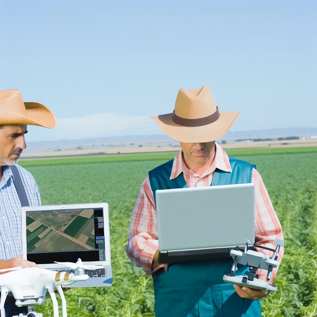
How Drone Technology Complements Satellite Imagery in Precision Farming
Overview of Satellite Imagery
Satellite imagery provides a broad perspective of agricultural landscapes.
This technology captures detailed data over vast areas.
Farmers can assess crop health, soil type, and moisture levels.
Additionally, it helps identify pest infestations and nutrient deficiencies.
High-resolution images enhance decision-making processes.
The Role of Drones in Agriculture
Drones offer a more localized view of farming operations.
They can fly low and capture high-resolution images of crops.
This capability allows farmers to monitor specific fields effectively.
Showcase Your Farming Business
Publish your professional farming services profile on our blog for a one-time fee of $200 and reach a dedicated audience of farmers and agribusiness owners.
Publish Your ProfileMoreover, drones can conduct real-time assessments during the growing season.
They often deliver actionable insights more rapidly than satellite data.
Combining Satellite and Drone Data
The integration of both technologies offers greater precision.
Drones fill in the gaps left by satellite observations.
Combining data creates a comprehensive mapping of field conditions.
This synthesis enhances field variability analysis.
Farmers gain a deeper understanding of microclimates and topography.
Case Studies in Precision Farming
Farmers like Laura Mitchell utilize both drones and satellite data.
In her vineyard, she uses drones for targeted spraying.
This method minimizes chemical usage while maximizing crop yield.
Furthermore, Eric Thompson employs satellite imagery to plan irrigation.
His farms demonstrate improved water efficiency as a result.
Advancements and Future Directions in Agricultural Technology
Advancements in both drone and satellite technology are ongoing.
Future innovations promise even higher-resolution imagery and data accuracy.
Integrating artificial intelligence may revolutionize data interpretation.
This integration could lead to autonomous farming solutions.
Farmers are likely to see increased productivity and sustainability.
Uncover the Details: Precision Agriculture Techniques for Sustainable Crop Management
The Role of GIS in Interpreting Satellite Data
Understanding Geographic Information Systems
Geographic Information Systems (GIS) play a crucial role in precision agriculture.
They help analyze satellite data effectively and provide valuable insights.
GIS integrates various data sources, including satellite imagery and soil information.
As a result, farmers gain a comprehensive understanding of their fields.
Enhancing Data Visualization
GIS enhances the visualization of satellite data through mapping technologies.
This technology allows farmers to see patterns in crop health across their fields.
Furthermore, it enables the layering of multiple data sets for better analysis.
Farmers can identify areas that need attention, such as pest infestations or nutrient deficiencies.
Facilitating Decision Making
GIS supports informed decision making in agriculture.
It empowers farmers to make precise interventions at the right time.
Using GIS, farmers can plan irrigation, planting, and harvesting schedules effectively.
This leads to improved yields and resource management.
Improving Resource Management
With GIS, farmers can manage resources more efficiently.
They can track water usage and soil health over time.
This capability helps optimize inputs, such as fertilizers and pesticides.
Consequently, farms become more sustainable and cost-effective.
Real-World Applications Demonstrating GIS Benefits
Several case studies highlight GIS’s impact on precision agriculture.
A farm in Iowa used GIS to increase corn yield by 15% through better resource allocation.
Similarly, a vineyard in California optimized irrigation using GIS analytics.
Such examples illustrate the transformative power of GIS technology.
Gain More Insights: Sustainable Irrigation Practices for Preserving Aquatic Ecosystems
Examples of Crop Health Monitoring Through Satellite and Drone Imagery
Introduction to Precision Agriculture
Precision agriculture utilizes technology to enhance farming practices.
Showcase Your Farming Business
Publish your professional farming services profile on our blog for a one-time fee of $200 and reach a dedicated audience of farmers and agribusiness owners.
Publish Your ProfileSatellite and drone imagery has revolutionized this approach.
By providing detailed data, farmers can make informed decisions.
Satellite Imagery for Crop Health Monitoring
Satellite imagery allows for comprehensive field analysis.
It captures large areas, making it ideal for extensive farms.
Farmers can monitor growth patterns and detect issues early.
For example, Planet Labs delivers daily satellite data.
This service helps farmers assess crop vigour over time.
Analyzing Vegetation Indices
Satellite images provide valuable vegetation indices.
This includes the Normalized Difference Vegetation Index (NDVI).
NDVI helps identify areas with healthy versus stressed plants.
By monitoring these indices, farmers can optimize inputs.
Drone Technology in Agriculture
Drones offer a unique advantage due to their flexibility.
They can fly lower and capture high-resolution images.
This precision enables farmers to assess specific problem areas.
Companies like senseFly specialize in agricultural drones.
Their drones create detailed field maps swiftly.
Real-time Data Collection
Drones provide real-time data for immediate action.
Farmers can adjust irrigation or fertilization based on insights.
This proactive approach enhances overall crop management.
Combining Technologies for Maximum Impact
The integration of satellite and drone data enhances monitoring.
Farmers gain a clearer picture of their fields’ health.
Using both technologies allows for cross-referencing data.
This dual approach leads to more accurate assessments.
Case Studies and Success Stories
Numerous farmers have reported success using these technologies.
For instance, Harrison Farms in California saw yield increases.
They utilized drone data to pinpoint irrigation inefficiencies.
Similarly, Green Valley Farms benefited from satellite data.
They adjusted planting schedules based on growth predictions.
Explore Further: Sustainable Farm Certification for Sustainable Aquaponics and Hydroponics
Precision Irrigation Techniques Enhanced by Satellite and Drone Technology
Introduction to Precision Irrigation
Precision irrigation optimizes water usage in agriculture.
This technique enhances crop yield while conserving resources.
Farmers use technology to monitor soil health and moisture levels.
Role of Satellite Technology
Satellites provide real-time data on weather patterns.
This information helps farmers make informed irrigation decisions.
Imagery from satellites allows farmers to analyze field variability.
They can assess areas needing more or less water efficiently.
Benefits of Satellite Data
Satellite data improves accuracy in water distribution.
Farmers can save on water and reduce costs significantly.
The use of satellite technology promotes sustainable farming practices.
Enhancements from Drone Technology
Drones capture high-resolution images of crops.
Showcase Your Farming Business
Publish your professional farming services profile on our blog for a one-time fee of $200 and reach a dedicated audience of farmers and agribusiness owners.
Publish Your ProfileThis technology assesses plant health over large areas rapidly.
Farmers can identify irrigation needs more quickly than before.
Detailed Crop Monitoring
Drones provide thermal imaging to detect moisture levels.
Farmers receive precise maps indicating water stress zones.
This data enables targeted irrigation, conserving water resources.
Combining Technologies for Maximum Efficiency
Using both satellites and drones creates a comprehensive analysis.
Farmers can implement data-driven irrigation strategies effectively.
Combining technologies minimizes waste and maximizes productivity.
Enhancing Crop Resilience through Efficient Irrigation
Efficient irrigation practices support crop resilience.
Healthy plants can better withstand environmental stresses.
This adaptability equates to higher yields in fluctuating climates.
Uncover the Details: Biogas Production and Its Role in Farm Sustainability
Cost-Effectiveness of Utilizing Drones and Satellites Versus Traditional Farming Methods
Introduction to Precision Agriculture
Precision agriculture transforms farming through advanced technologies.
Drones and satellites provide critical data for better decision-making.
This approach minimizes waste and maximizes yield.
Lowering Operational Costs
Flying drones reduce the need for manual labor in crop monitoring.
This cuts down on labor costs significantly.
Moreover, satellite imagery allows farmers to monitor vast areas swiftly.
In contrast, traditional methods involve time-consuming ground checks.
Enhanced Resource Management
Drones help optimize water use by identifying dry areas.
Farmers can allocate water resources efficiently based on real-time data.
Also, satellite data assists in determining optimal fertilizer application.
Such precise applications reduce excess spending on farm inputs.
Improved Crop Monitoring
Drones provide high-resolution images of crop health.
This level of detail surpasses traditional scouting methods.
Consequently, farmers detect issues early, minimizing losses.
Timely intervention helps improve overall crop yields.
Cost-Benefit Comparison of Modern Technologies
Investing in drone technology offers significant long-term savings.
Upfront costs are often balanced by increased efficiency and higher yields.
Farmers can avoid excessive investment in machinery and fuel.
Thus, precision agriculture techniques can pay for themselves rapidly.
Examples of Successful Technology Implementations in Farming
For instance, Evergreen Fields reduced pesticide use by 30%.
They implemented drone technology for targeted application.
Furthermore, Blue River Farms increased their corn yield by 40% using satellite data.
Such results illustrate the power of technology in modern farming.
Benefits of Adopting Drones and Satellites in Farming
The evidence is clear: drones and satellites enhance cost-efficiency.
Adopting these technologies paves the way for a sustainable agricultural future.
Farmers can achieve more with less, benefiting their operations and the environment.
Future Trends in Agricultural Technology
Integration of AI and Machine Learning
The future of agriculture lies in advanced technologies.
AI and machine learning enhance crop management practices.
Showcase Your Farming Business
Publish your professional farming services profile on our blog for a one-time fee of $200 and reach a dedicated audience of farmers and agribusiness owners.
Publish Your ProfileThese technologies analyze data captured from satellites and drones.
Additionally, they optimize resource use and improve yields.
Benefits of AI in Precision Agriculture
AI algorithms can predict weather patterns effectively.
Farmers utilize these predictions for timely planting and harvesting.
Moreover, AI identifies pest infestations early on.
This proactive approach minimizes crop damage significantly.
Consequently, farmers can implement targeted interventions.
Enhancements Through Machine Learning
Machine learning refines data analysis capabilities in agriculture.
This technology learns from historical data to inform future decisions.
Farmers benefit from personalized crop management strategies.
Additionally, machine learning helps in soil health monitoring.
Thus, it supports sustainable farming practices.
Impact on Crop Yields
The integration of these technologies leads to increased crop yields.
Farmers achieve higher efficiency in resource allocation.
This translates into less waste and improved profitability.
Furthermore, precision agriculture supports environmental sustainability.
Therefore, it fosters a balance between production and conservation.
Future Innovations in Drone Technology
Innovations in drone technology will enhance agricultural practices.
Drones can cover large areas rapidly and efficiently.
They provide real-time data on crop conditions and growth patterns.
Consequently, farmers can make informed decisions instantly.
As a result, operational costs decrease while productivity increases.
Satellite Technology Advancements
Advancements in satellite technology provide comprehensive agricultural insights.
Farmers access high-resolution imagery of their fields.
This imagery aids in assessing plant health and soil quality.
Moreover, satellites offer extensive weather forecasts and climate modeling.
Such data is crucial for planning farming activities effectively.
Challenges and Considerations in Technology Adoption
Despite advancements, challenges remain in technology adoption.
Farmers may face barriers due to cost and training needs.
Additionally, privacy concerns arise with data collection.
Overcoming these challenges is crucial for widespread technology use.
Future policies must support equitable access to technology.
Additional Resources
Precision Agriculture in the Digital Era: Recent Adoption on U.S. Farms
Sustainability and Precision Agriculture in Cotton Production – Trust …