Introduction to Remote Sensing in Agriculture
Remote sensing revolutionizes the way we understand agriculture.
This technology allows us to collect data from a distance.
Farmers effectively monitor their crops’ health and growth.
Additionally, remote sensing provides insights into soil conditions.
Overview of Remote Sensing Technology
Remote sensing utilizes satellites and drones to gather information.
These devices acquire images and data that are essential for analysis.
Furthermore, they can detect changes over time, offering valuable trends.
This data aids in making informed decisions on crop management.
Benefits of Remote Sensing in Agriculture
Remote sensing enhances productivity and efficiency in farming.
It allows for precise monitoring of resources like water and nutrients.
Farmers can identify stressed areas in fields quickly.
This technology helps in optimizing pesticide and fertilization applications.
Moreover, it supports sustainable agricultural practices.
Applications in Precision Agriculture
Precision agriculture heavily relies on remote sensing techniques.
Farmers can implement variable rate technology for better crop management.
Transform Your Agribusiness
Unlock your farm's potential with expert advice tailored to your needs. Get actionable steps that drive real results.
Get StartedThis approach reduces waste and increases yields significantly.
Remote sensing also aids in assessing crop inventory levels.
Farmers can respond faster to changing agricultural conditions.
Overview of Precision Agriculture and Its Benefits
Defining Precision Agriculture
Precision agriculture utilizes technology to enhance farming practices.
It focuses on increasing crop yields while minimizing waste.
This approach uses data-driven methods to inform decision-making.
Technological Innovations
Remote sensing plays a crucial role in precision agriculture.
It provides real-time data about soil and crop conditions.
Farmers can monitor fields using satellite imagery and drones.
Benefits of Precision Agriculture
Higher efficiency is one major advantage of precision agriculture.
Farmers can apply resources like water and fertilizers more effectively.
This reduces costs and promotes sustainable farming practices.
Improved Crop Yields
Precision agriculture leads to higher crop yields through optimized inputs.
Farmers can diagnose issues early to prevent losses.
Environmental Sustainability
This method aids in conserving natural resources.
For instance, it minimizes chemical runoff into nearby waters.
As a result, it fosters healthier ecosystems.
Informed Decision-Making
Data analysis supports better agricultural decisions.
Farmers can predict outcomes based on precise information.
This enhances overall farm management practices.
Future Directions in Precision Agriculture
Precision agriculture marks a transformative approach in farming.
As technology advances, its impact will likely increase.
Farmers who adopt these strategies will thrive in the future.
Key Remote Sensing Technologies Used in Agriculture
Introduction to Remote Sensing in Agriculture
Remote sensing significantly transforms modern agriculture.
Showcase Your Farming Business
Publish your professional farming services profile on our blog for a one-time fee of $200 and reach a dedicated audience of farmers and agribusiness owners.
Publish Your ProfileThis technology provides crucial data for farmers every season.
Farmers rely on remote sensing to optimize yields and manage crops effectively.
Additionally, this approach contributes to sustainable farming practices.
Satellite Imagery
Satellite imagery serves as a backbone for remote sensing in agriculture.
It captures large-scale data across various landscapes.
Farmers use satellite images to monitor crop health and land conditions.
High-resolution images reveal valuable insights regarding irrigation needs.
Furthermore, they help in assessing damage from pests or diseases.
Drones in Precision Agriculture
Drones offer unique advantages over traditional methods.
They collect detailed information from hard-to-reach areas.
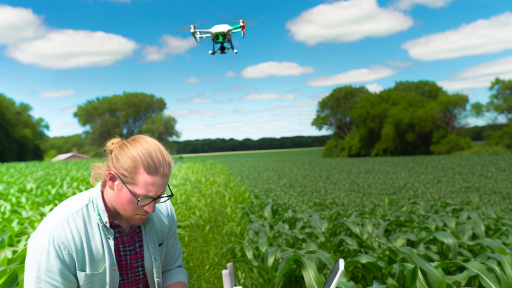
Farmers can deploy drones for real-time monitoring of fields.
This technology enhances efficiency in tasks such as crop scouting.
Moreover, drones enable precise application of pesticides and fertilizers.
LiDAR Technology
LiDAR technology provides high-precision topographic data.
This data aids in understanding field variability and drainage patterns.
Farmers can make informed decisions regarding land management.
Additionally, LiDAR helps in implementing efficient irrigation systems.
Improved water management leads to enhanced crop productivity.
Remote Sensing Platforms
Various platforms exist to gather remote sensing data.
They range from satellites to drones and ground-based sensors.
Each platform offers distinct benefits for agricultural monitoring.
For instance, satellites provide extensive spatial coverage.
In contrast, drones facilitate focused, high-resolution analyses.
Data Integration and Analysis
Integrating remote sensing data enhances agricultural decision-making.
Farmers analyze historical and current data for better insights.
Common analysis methods include image processing and machine learning.
These techniques improve predictive models for crop management.
Ultimately, data-driven decisions lead to increased yields and resource efficiency.
Find Out More: Robots Improving Soil Health And Management
Applications of Satellite Imaging for Crop Monitoring
Enhancing Crop Health Assessment
Satellite imaging provides real-time insights into crop health.
This technology enables farmers to quickly identify areas of stress.
Using multispectral imagery, they can assess plant health effectively.
Colors that indicate plant health appear vividly in the images.
Farmers can target specific areas with precision and minimize waste.
Consequently, they improve overall crop yield and sustainability.
Monitoring Soil Moisture Levels
Satellite data helps monitor soil moisture across large fields.
Farmers receive crucial information regarding irrigation needs.
Understanding soil moisture enhances water management practices.
This technology allows for precision irrigation that saves resources.
Farmers can reduce costs while promoting healthier crops.
Showcase Your Farming Business
Publish your professional farming services profile on our blog for a one-time fee of $200 and reach a dedicated audience of farmers and agribusiness owners.
Publish Your ProfileUltimately, this leads to sustainable agricultural practices.
Tracking Crop Growth Stages
Satellite images help track the growth stages of various crops.
Farmers can observe and analyze growth patterns over time.
This data aids in making timely decisions for crop management.
By understanding growth stages, they can optimize nutrient applications.
Furthermore, it supports better harvest timing to maximize yield.
This valuable information leads to more efficient farming operations.
Assessing Pest and Disease Outbreaks
Satellite imaging plays a critical role in pest and disease monitoring.
Farmers can detect infestations and disease spread through imagery.
This early detection minimizes crop damage and losses.
Targeted interventions become possible with accurate data.
As a result, farmers can manage pest control effectively.
This enhances overall crop resilience and productivity.
Estimating Crop Yields
Satellite data helps estimate potential crop yields before harvest.
Farmers gain insights into the productivity of their fields.
This helps in planning post-harvest strategies efficiently.
Accurate yield predictions assist with market preparation.
Farmers can make informed financial decisions based on this data.
Overall, accurate estimations support better supply chain management.
Integrating Data for Precision Agriculture
Combining satellite imagery with other data sources enhances agriculture.
This integration improves decision-making processes on the farm.
Farmers can utilize data analytics tools for deeper insights.
Incorporating weather data helps anticipate environmental changes.
Thus, farmers can adapt to conditions proactively.
This holistic approach fosters sustainable farming practices.
Delve into the Subject: The Future of Farming with Smart Irrigation
Use of Drones for Real-Time Data Collection in Farming
Benefits of Drone Technology
Drones provide farmers with real-time data on crop conditions.
This technology allows for timely decision-making in farming operations.
Farmers can monitor large fields quickly and efficiently.
Moreover, drones can collect data that would be difficult to obtain otherwise.
Types of Drones Used in Agriculture
Various types of drones assist in agricultural practices.
Fixed-wing drones cover expansive areas with ease.
Rotary-wing drones offer greater maneuverability for detailed inspections.
Hybrid drones combine the advantages of both types for versatility.
Data Collection Capabilities
Drones collect critical data through various sensors.
Multispectral sensors analyze plant health and moisture levels.
Thermal sensors detect temperature differences in crops.
This data helps identify stress areas and optimize interventions.
Integrating Drone Data with Other Technologies
Farmers can integrate drone data with geographic information systems (GIS).
This integration enhances the analysis of spatial data.
Showcase Your Farming Business
Publish your professional farming services profile on our blog for a one-time fee of $200 and reach a dedicated audience of farmers and agribusiness owners.
Publish Your ProfileCombining drones with agricultural software creates a comprehensive management system.
Farmers can visualize trends and make informed decisions.
Challenges and Considerations
Despite their advantages, drones pose some challenges.
Regulatory compliance can complicate drone use in farming.
Farmers must also consider weather conditions that impact drone performance.
Furthermore, initial costs can be a barrier for some farmers.
Gain More Insights: Data-Driven Irrigation Strategies for Farmers
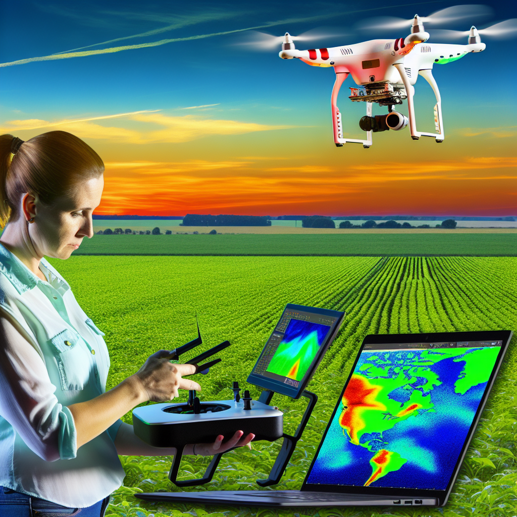
Integrating Remote Sensing Data with GIS for Better Decision Making
Understanding Remote Sensing Technology
Remote sensing technology uses satellite or aerial imagery to collect data.
This data helps farmers monitor crop health and assess land use changes.
It also aids in identifying pest infestations and nutrient deficiencies.
The Role of GIS in Agriculture
Geographic Information Systems (GIS) organize and analyze spatial data.
GIS allows farmers to visualize patterns and trends over time.
These insights lead to more informed decision-making processes.
Combining Remote Sensing and GIS
Combining remote sensing data with GIS enhances data interpretation.
This integration provides a more comprehensive view of agricultural fields.
As a result, farmers can track changes and respond swiftly.
Improving Precision Agriculture
Precision agriculture focuses on optimizing field variability in crops.
Remote sensing technology provides real-time information essential for this.
Farmers can apply inputs more efficiently and reduce waste.
Implementing Data-Driven Decisions
Data-driven decisions help maximize yield and minimize costs.
Farmers can analyze growth patterns and adjust irrigation accordingly.
Moreover, they can predict harvest times based on crop development data.
Challenges and Opportunities
Integrating remote sensing data with GIS presents challenges.
Data processing and analysis require specialized expertise and software.
However, these challenges create opportunities for innovation and growth.
Emerging technologies promise to simplify and enhance integration.
You Might Also Like: Smart Irrigation Systems in Precision Agriculture
Challenges and Limitations of Remote Sensing in Agriculture
Technological Limitations
Remote sensing technology faces several inherent limitations in agriculture.
One major challenge is the resolution of data.
High-resolution imagery can be expensive and sometimes inaccessible.
Additionally, weather conditions often affect data quality.
Cloud cover can obscure critical observations.
This makes timely assessments difficult for farmers.
Data Processing and Interpretation
Data processing presents its own set of challenges.
Farmers require specialized software for data analysis.
This software often necessitates technical expertise.
Consequently, many farmers struggle to interpret results accurately.
As a result, the potential value of data may remain untapped.
Cost Implications
Cost is a significant barrier to effective usage of remote sensing in agriculture.
Initial investments in technology can be considerable.
Showcase Your Farming Business
Publish your professional farming services profile on our blog for a one-time fee of $200 and reach a dedicated audience of farmers and agribusiness owners.
Publish Your ProfileMoreover, ongoing expenses for maintenance add up.
Farmers with limited budgets may find these costs prohibitive.
This restricts their ability to implement precision agriculture practices.
Integration with Existing Practices
Integrating remote sensing data with established agricultural practices is complex.
Farmers often rely on traditional methods for decision-making.
Changing these practices can require extensive training.
Thus, there exists a resistance to adopting new technologies.
First, farmers need to understand the benefits fully.
Regulatory and Privacy Concerns
Regulatory frameworks can hinder the use of remote sensing.
Privacy concerns may also arise regarding land monitoring.
Farmers may worry about who accesses their data.
This uncertainty can prevent engagement in remote sensing applications.
Clear regulations are crucial for building trust among users.
Future Trends in Remote Sensing Technologies for Precision Agriculture
Emerging Technologies
Unmanned Aerial Vehicles (UAVs) will play a significant role in precision agriculture.
These drones enable farmers to monitor crops effectively.
High-resolution imaging provides detailed insights into crop health.
Moreover, they can cover large areas quickly and efficiently.
Satellite Technologies
Satellites are becoming increasingly important for agricultural monitoring.
They offer broader coverage compared to UAVs.
New satellite missions will improve data availability and resolution.
Additionally, real-time data will enhance decision-making processes for farmers.
Machine Learning and AI Integration
Artificial Intelligence is revolutionizing data analysis in agriculture.
Machine learning algorithms can predict crop yield accurately.
These technologies analyze vast data sets to identify patterns and trends.
Consequently, farmers can make informed decisions about planting and harvesting.
Advancements in Sensor Technology
Innovative sensors are enhancing remote sensing capabilities.
Soil moisture sensors provide vital information to optimize irrigation.
With improved accuracy, farmers can use resources more efficiently.
Moreover, multispectral sensors aid in assessing plant health effectively.
Data Management Solutions
Robust data management systems are essential for handling large data volumes.
Farmers will benefit from user-friendly platforms that centralize data analysis.
Furthermore, these solutions will allow for better integration of various data sources.
As a result, farmers can gain holistic insights into their operations.
Regulatory and Policy Developments
Future regulations will impact the adoption of remote sensing technologies.
Policies promoting sustainable farming practices may drive technology integration.
Additionally, government incentives could encourage innovations in this sector.
Farmers must stay informed about these changes to remain competitive.
Collaborative Efforts
Collaboration between tech companies and farmers is crucial for innovation.
Joint ventures can lead to developing tailored solutions for specific needs.
Sharing knowledge will enhance the effectiveness of remote sensing technologies.
Showcase Your Farming Business
Publish your professional farming services profile on our blog for a one-time fee of $200 and reach a dedicated audience of farmers and agribusiness owners.
Publish Your ProfileUltimately, these partnerships will create a more sustainable agricultural landscape.
Additional Resources
Precision Agriculture: Benefits and Challenges for Technology …
Long He, Ph.D. — Directory — Department of Agricultural and …

