Introduction to Remote Sensing Technologies in Agriculture
Remote sensing technologies revolutionize agricultural management practices.
These technologies allow farmers to monitor crops from a distance.
They utilize sensors to gather valuable data about the land.
This data helps optimize farming operations and boost productivity.
Types of Remote Sensing Technologies
There are various types of remote sensing technologies available.
Satellite imagery provides comprehensive views of large agricultural areas.
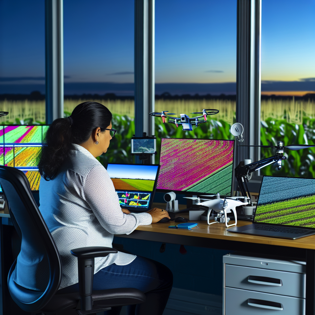
Drone technology offers high-resolution images for targeted analyses.
Ground-based sensors capture data about soil and crop conditions.
Applications in Crop Monitoring
Remote sensing plays a critical role in crop monitoring.
Farmers can detect areas of stress in their fields quickly.
This allows for timely intervention, improving crop health.
Furthermore, remote sensing aids in assessing crop yield potential.
Benefits of Remote Sensing
Employing remote sensing technologies enhances efficiency.
It reduces labor costs by automating data collection processes.
Moreover, it minimizes environmental impacts by optimizing resource use.
Transform Your Agribusiness
Unlock your farm's potential with expert advice tailored to your needs. Get actionable steps that drive real results.
Get StartedFarmers can also make informed decisions based on accurate data.
Challenges and Considerations
Despite the advantages, challenges exist in remote sensing adoption.
High initial costs may deter some farmers from using these technologies.
Additionally, data interpretation can require specialized knowledge.
Farmers must be trained to utilize the data effectively.
Future Trends in Remote Sensing
The future of remote sensing in agriculture looks promising.
Emerging technologies continue to improve data accuracy and accessibility.
Integration with artificial intelligence guarantees enhanced insights.
Ultimately, these advancements will support sustainable farming practices.
Types of Remote Sensing Technologies Used in Agricultural Management
Satellite Imagery
Satellite imagery plays a crucial role in agricultural management.
Farmers use it to monitor crop health over large areas.
This technology provides detailed information about soil moisture levels.
Additionally, it helps identify pest infestations and diseases.
Data from satellites assists in making informed decisions rapidly.
Drone Technology
Drones have revolutionized agricultural monitoring.
These aerial vehicles can capture high-resolution images of fields.
Farmers utilize drones for assessing crop growth stages accurately.
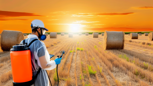
They are also effective for precision spraying of fertilizers and pesticides.
Furthermore, drone data can improve yield estimates and resource allocation.
Ground-Based Sensors
Ground-based sensors are essential for real-time data collection.
These devices measure soil moisture, temperature, and nutrient levels.
Farmers can make immediate adjustments based on sensor readings.
Consequently, this technology maximizes crop performance and efficiency.
Moreover, it reduces unnecessary water and fertilizer use.
Showcase Your Farming Business
Publish your professional farming services profile on our blog for a one-time fee of $200 and reach a dedicated audience of farmers and agribusiness owners.
Publish Your ProfileRemote Sensing Software
Remote sensing software analyzes data from various sources.
This software provides insights that guide farmers’ decisions.
Users can visualize data through user-friendly interfaces.
These tools help track changes in crop health over time.
Additionally, software enhances predictive analytics capabilities.
Integration with IoT Devices
The integration of remote sensing with IoT devices is transformative.
IoT devices can gather data from the field continuously.
When combined with remote sensing, they enhance data accuracy.
This integration enables automation of irrigation systems.
Furthermore, it fosters data-driven farming practices effectively.
Advantages of Remote Sensing in Crop Monitoring and Yield Prediction
Enhanced Data Collection
Remote sensing technologies enable rapid data collection across vast agricultural areas.
Farmers can gather information without stepping into the fields.
This method saves time and reduces labor costs significantly.
Real-Time Monitoring
Real-time monitoring allows farmers to keep an eye on their crops continuously.
They can quickly identify issues such as pests or diseases.
Furthermore, timely interventions can significantly improve yield outcomes.
Detailed Analysis of Crop Health
Remote sensing provides detailed insights into crop health status.
It utilizes spectral data to assess plant vigor and stress levels.
Farmers can make informed decisions about irrigation and fertilization accordingly.
Improved Yield Predictions
Yield predictions become more accurate with remote sensing technologies.
Farmers can analyze historical data alongside real-time information.
This advanced method enhances forecasting and planning efforts.
Cost Efficiency
Overall costs are reduced through the efficient use of resources.
Farmers save on manual labor and material inputs such as fertilizers.
Remote sensing helps optimize resource allocation, leading to higher profitability.
Environmental Monitoring
Remote sensing technologies contribute to environmental conservation.
Farmers can monitor soil moisture levels and manage water usage efficiently.
This leads to more sustainable farming practices that help preserve ecosystems.
Data Integration and Decision Support
Remote sensing facilitates the integration of various data sources.
Farmers can combine weather data, soil data, and crop data seamlessly.
This comprehensive analysis supports better decision-making and strategy formulation.
Uncover the Details: Best Cover Crops to Improve Soil Fertility
Integration of Remote Sensing with GIS for Land Management
Overview of Remote Sensing and GIS
Remote sensing involves acquiring data about the Earth’s surface from a distance.
This technology utilizes satellites or aerial sensors to collect vital information.
On the other hand, Geographic Information Systems (GIS) manage spatial data effectively.
GIS allows users to visualize, analyze, and interpret geographic data.
Combining both technologies enhances agricultural land management practices.
Benefits of Integration
Integrating remote sensing with GIS increases accuracy in data collection.
This combination provides detailed insights into land use and crop health.
Farmers can make informed decisions based on real-time data.
Showcase Your Farming Business
Publish your professional farming services profile on our blog for a one-time fee of $200 and reach a dedicated audience of farmers and agribusiness owners.
Publish Your ProfileMoreover, it facilitates the identification of potential areas for improvement.
Additionally, this integration helps track environmental changes over time.
Applications in Agricultural Management
Integrated systems can monitor crop growth and health dynamically.
Remote sensing provides images that highlight areas needing attention.
GIS further analyzes this data to inform management strategies.
For instance, it assists in precision farming techniques.
These techniques optimize inputs like water and fertilizers to increase yield.
Implementation Challenges
Despite the advantages, challenges exist in implementation.
Data acquisition can be costly and time-consuming.
Furthermore, integrating various data sources requires significant technical expertise.
Another challenge includes ensuring data accuracy and reliability.
Addressing these challenges is crucial for successful implementation.
Future Trends
The future of agricultural management will see advancements in technology.
Emerging AI and machine learning techniques will refine data analysis.
Moreover, greater accessibility to satellite data will enhance usage.
Farmers will increasingly rely on these technologies to improve crop yields.
This shift will support sustainable agricultural practices globally.
You Might Also Like: Mulching for Pest Management in Crop Cultivation
Case Studies: Successful Applications of Remote Sensing in Agriculture
Precision Agriculture in Corn Production
Farmers use remote sensing technologies to monitor corn crop health.
They can detect nutrient deficiencies and pest infestations early.
For instance, GreenField Farms utilized satellite imagery effectively.
Their team analyzed NDVI data to optimize fertilizer application.
This approach significantly increased corn yields by 15% last season.
Water Resource Management in Rice Cultivation
Water scarcity poses a serious threat to rice farming globally.
Remote sensing helps farmers in efficient water resource management.
AgriTech Solutions employed drones for real-time water analysis.
Through thermal imaging, they identified irrigation needs accurately.
This method reduced water usage by 20% without compromising yields.
Crop Monitoring and Yield Prediction
Accurate yield forecasting is essential for agricultural planning.
FarmData Inc. harnessed remote sensing for precise yield estimates.
They integrated satellite data with machine learning algorithms.
This combination improved forecasting accuracy by 30%.
Farmers benefitted from better market timing and pricing strategies.
Disease Detection in Orchard Management
Early disease detection can save crops and reduce losses.
OrchardMonitor used aerial imagery to identify tree diseases.
Their system analyzed color variations to spot health issues promptly.
This enhanced their response time, improving overall fruit quality.
Consequently, the orchard reported a 40% decrease in crop losses.
Soil Health Assessment Using Spectral Data
Understanding soil health is vital for sustainable farming practices.
SoilSmart Technologies employed spectral remote sensing techniques.
Showcase Your Farming Business
Publish your professional farming services profile on our blog for a one-time fee of $200 and reach a dedicated audience of farmers and agribusiness owners.
Publish Your ProfileThey assessed soil composition and moisture levels precisely.
This data supported targeted amendments to enhance soil fertility.
The farm saw improved crop resilience to climatic changes.
Discover More: Benefits of Mulching for Soil Structure and Fertility

Challenges and Limitations of Remote Sensing Technologies in Farming
Data Quality and Accuracy
Remote sensing technologies rely on high-quality data for effective analysis.
Data accuracy can vary due to environmental conditions.
Cloud cover and atmospheric interference often degrade images.
Off-nadir angles can result in distorted measurements.
Inconsistent data collection methods further complicate results.
Cost and Accessibility
Implementing remote sensing technologies can be financially burdensome for many farmers.
The initial costs of equipment and software can be significant.
Moreover, ongoing maintenance and updates add to these expenses.
Access to advanced technologies often remains limited in rural areas.
Technical Expertise Requirements
Utilizing remote sensing technologies demands a specific skill set.
Farmers often need training to interpret complex data.
This requirement can create a barrier for those lacking technical knowledge.
Partnerships with specialists may be necessary, adding complexity.
Integration with Existing Systems
Farmers frequently face challenges integrating remote sensing with current practices.
Legacy equipment may not easily connect with new technologies.
This lack of compatibility can lead to inefficiencies.
Thus, a cohesive strategy for integration is crucial for effectiveness.
Data Management and Interpretation
Remote sensing generates vast amounts of data.
This data requires careful management and analysis for useful insights.
Farmers might struggle to extract actionable information from raw data.
Overwhelming data can hinder decision-making processes.
Regulatory and Privacy Concerns
Remote sensing technologies may raise regulatory issues related to privacy.
Farmers must navigate laws that govern aerial surveillance and data usage.
Compliance can create additional administrative burdens.
Understanding local regulations is crucial for proper implementation.
Explore Further: Crop Rotation Strategies for Healthy Soils
Future Trends: Innovations in Remote Sensing for Agricultural Practices
Advances in Technology
Remote sensing technology continues to evolve rapidly.
These advancements enhance agricultural monitoring capabilities.
Farmers now leverage drones for detailed crop analysis.
Satellite imagery provides comprehensive data about larger areas.
Moreover, sensors collect vital information from the field.
Integration of Artificial Intelligence
Artificial intelligence plays a key role in data analysis.
Farmers utilize AI algorithms to process remote sensing data.
This approach enables precise decision-making about crop management.
AI identifies patterns that help optimize resource allocation.
Consequently, agricultural efficiency improves significantly.
Showcase Your Farming Business
Publish your professional farming services profile on our blog for a one-time fee of $200 and reach a dedicated audience of farmers and agribusiness owners.
Publish Your ProfilePrecision Agriculture Techniques
Precision agriculture relies heavily on remote sensing technologies.
This methodology allows farmers to apply inputs more accurately.
Remote sensing data guides planting and harvesting processes.
Farmers can identify underperforming areas within their fields.
This targeted approach reduces costs and increases yield.
Enhanced Soil Health Monitoring
Soil health is crucial for sustainable farming practices.
Remote sensing tools monitor soil moisture and nutrient levels.
This information helps farmers manage soil more effectively.
By understanding soil conditions, crop productivity increases.
Further, monitoring leads to improved long-term soil management.
Future Innovations on the Horizon
Looking ahead, innovations continue to emerge in remote sensing.
Advances in hyperspectral imaging will offer deeper insights.
New technologies will focus on real-time monitoring solutions.
Integrating blockchain with remote sensing will enhance data security.
These innovations promise to revolutionize agricultural practices.
The Role of Remote Sensing in Sustainable Agriculture
Enhancing Resource Management
Remote sensing technologies revolutionize agricultural resource management.
They provide precise data on soil moisture and nutrient levels.
This information allows farmers to apply fertilizers and irrigation more efficiently.
Consequently, they can reduce waste and lower operational costs.
Monitoring Crop Health
These technologies enable continuous monitoring of crop health.
Farmers can detect signs of stress, disease, or pest infestations early.
This prompt action can prevent significant yield losses.
Additionally, remote sensing helps in assessing crop performance over time.
Supporting Decision-Making Processes
Data gathered from remote sensing aids informed decision-making.
Agronomists can analyze data to implement targeted interventions.
This approach optimizes crop production and enhances sustainability.
Moreover, it supports precision agriculture practices that maximize efficiency.
Promoting Sustainable Practices
Remote sensing contributes to sustainable agricultural practices.
It helps farmers understand environmental impacts better.
As a result, they can adopt strategies that protect natural resources.
Sustainable practices lead to healthier ecosystems and enhanced biodiversity.
Future Developments and Potential
The future of remote sensing in agriculture looks promising.
Technological advancements will improve data accuracy and accessibility.
Farmers will increasingly rely on these tools for decision-making.
Ultimately, this shift will promote a more sustainable agricultural landscape.
Remote sensing technologies play a crucial role in sustainable agriculture.
They enhance resource management, monitor crop health, and support effective decision-making.
Embracing these innovations fosters environmentally responsible practices.
Consequently, agriculture can meet current and future challenges sustainably.
Additional Resources
Precision Agriculture: Benefits and Challenges for Technology …
Showcase Your Farming Business
Publish your professional farming services profile on our blog for a one-time fee of $200 and reach a dedicated audience of farmers and agribusiness owners.
Publish Your ProfileFederal Strategy to Advance Greenhouse Gas Emissions …


