Introduction to Remote Sensing in Agriculture
Remote sensing has transformed modern agriculture significantly.
Farmers can now monitor their crops from a distance using advanced technologies.
This method provides vital information about crop health and growth patterns.
Consequently, it helps optimize agricultural practices for better yields.
Understanding Remote Sensing Technology
Remote sensing involves collecting data from satellites or aerial platforms.
These tools use sensors to capture images and analyze data over large areas.
For example, multispectral and hyperspectral sensors provide detailed insights.
They measure various wavelengths of light reflected from crops.
This data reveals critical information about plant health and stress levels.
Applications in Crop Management
Farmers use remote sensing for precise agricultural management.
One primary application is crop monitoring and assessment.
Additionally, it aids in identifying pest infestations and disease outbreaks.
This information allows for timely interventions, reducing losses.
Benefits of Using Remote Sensing
Remote sensing enhances decision-making in agriculture.
By utilizing accurate data, farmers can make informed choices.
Transform Your Agribusiness
Unlock your farm's potential with expert advice tailored to your needs. Get actionable steps that drive real results.
Get StartedThis approach minimizes resource waste, such as water and fertilizers.
Furthermore, it helps in planning field operations efficiently.
Challenges and Considerations
Despite its advantages, remote sensing faces certain challenges.
The technology requires significant investment for farmers.
Moreover, accurate data interpretation necessitates expertise and training.
Adapting to new technologies can be a barrier for some farmers.
Future Perspectives
The future of remote sensing in agriculture looks promising.
Innovations in technology will likely enhance data accuracy and accessibility.
As it evolves, more farmers will adopt these tools for better productivity.
Integrating remote sensing in agriculture can lead to greater sustainability.
Overview of Crop Yield
Importance of Crop Yield
Crop yield represents the amount of crop produced per unit of land.
It serves as a critical metric for agricultural productivity.
Higher yields can directly impact food security and economic stability.
Thus, measuring crop yield is essential for effective farming practices.
Key Metrics for Measuring Crop Yield
Several key metrics help farmers evaluate crop yields.
Bushels per acre is a common measurement for cereals.
In contrast, pounds per acre often measure vegetable crops.
Estimating yield potential early in the growing season can guide management decisions.
Moreover, understanding historical yield data helps in forecasting future yields.
Factors Influencing Crop Yield
Multiple factors directly affect crop yield outcomes.
Weather conditions, including rainfall and temperature, play significant roles.
Soil health and fertility significantly impact overall yield as well.
Additionally, effective pest and weed management is crucial for maximizing yield.
Enhancing Crop Yield Through Technology
Advancements in agricultural technology can significantly boost crop yields.
Showcase Your Farming Business
Publish your professional farming services profile on our blog for a one-time fee of $200 and reach a dedicated audience of farmers and agribusiness owners.
Publish Your ProfileUtilizing remote sensing tools allows for real-time monitoring of crop health.
Data from these tools aids in precision farming strategies.
As a result, farmers can make informed decisions based on accurate data.
Types of Remote Sensing Tools Used in Agriculture
Satellite Imaging
Satellite imaging provides comprehensive views of agricultural fields.
This technology captures data from vast areas efficiently.
Several satellites are actively monitoring crops across the globe.
Farmers can assess crop health and growth patterns from this data.
Unmanned Aerial Vehicles
Unmanned aerial vehicles (UAVs) are revolutionizing agricultural monitoring.
These drones fly over fields and gather high-resolution images.
Farmers use UAVs to monitor crop conditions in real time.
Additionally, UAVs can assess field variability and soil conditions.
Ground-Based Sensors
Ground-based sensors collect detailed data directly from the field.
These sensors measure parameters like soil moisture and temperature.
Farmers gain insights into local conditions affecting crop growth.
The data aids in precise irrigation and fertilization practices.
Remote Sensing Software
Remote sensing software processes data collected from various tools.
This software provides analytical capabilities for decision-making.
Farmers can visualize crop health through diagnostic maps.
Moreover, it enables them to track yield projections effectively.
LiDAR Technology
Light Detection and Ranging (LiDAR) technology offers unique advantages.
It creates detailed topographical maps of agricultural land.
Farmers utilize these maps for effective field management strategies.
LiDAR enables precise planning of irrigation and planting systems.
See Related Content: Wireless Sensor Networks for Smart Farming
How Remote Sensing Enhances Crop Monitoring and Management
Introduction to Remote Sensing in Agriculture
Remote sensing uses advanced technology to observe agricultural fields from a distance.
This technology allows farmers to gather data without direct contact with the crops.
It revolutionizes traditional farming practices by providing real-time information.
Benefits of Remote Sensing for Crop Monitoring
Remote sensing technology enhances crop monitoring significantly.
It helps in identifying plant health efficiently across large areas.
Farmers can easily detect stress factors, such as pests or diseases.
This approach saves time compared to traditional scouting methods.
Regular monitoring supports timely interventions and better crop management.
Efficient Resource Management
Remote sensing enables precise resource allocation for crops.
Farmers can monitor soil moisture levels using satellite imagery.
This data helps in optimizing irrigation schedules for better water use.
Additionally, it assists in determining fertilizer application timings.
Yield Prediction and Assessment
Remote sensing plays a vital role in predicting crop yields.
Farmers can analyze growth patterns over time and assess final yields.
These predictions allow for better financial planning and market strategies.
Integration with Agricultural Practices
Integrating remote sensing data with existing farming practices is crucial.
Showcase Your Farming Business
Publish your professional farming services profile on our blog for a one-time fee of $200 and reach a dedicated audience of farmers and agribusiness owners.
Publish Your ProfileThis synergy enhances decision-making processes for farmers.
Farmers can utilize data analytics tools for detailed insights.
Consequently, they can develop customized management plans tailored to their fields.
Real-World Applications of Remote Sensing
Numerous farmers and agricultural companies leverage remote sensing technology.
For instance, GreenField Technologies uses drones to capture detailed aerial imagery.
These images provide insights into crop health and soil conditions.
Furthermore, HarvestSmart combines satellite data with IoT devices for real-time monitoring.
Such innovations significantly increase productivity and efficiency in farming.
Future Trends in Remote Sensing
The future of remote sensing in agriculture looks promising.
Advancements in drone technology will enhance data collection capabilities.
Moreover, machine learning algorithms will improve data analysis accuracy.
As a result, farmers will have better tools for diagnosing issues and planning.
Ultimately, remote sensing will continue to boost crop yields and sustainability.
Learn More: Automated Machinery for Organic Farming Practices
Impact of Remote Sensing on Precision Agriculture Practices
Introduction to Remote Sensing
Remote sensing technology offers vital insights for modern agriculture.
Farmers utilize data collected from satellites and drones.
This data allows for precise monitoring of crop health and growth.
Enhancing Crop Monitoring
Remote sensing significantly boosts crop monitoring efficiency.
Farmers can detect problems early, such as pest infestations.
Additionally, this technology helps assess water stress levels.
Moreover, it provides information on nutrient deficiencies promptly.
Improving Resource Management
Efficient resource management is crucial for sustainable agriculture.
Remote sensing facilitates optimal irrigation practices.
This technique minimizes water waste and enhances crop yield.
Moreover, it enables farmers to apply fertilizers more effectively.
Data-Driven Decision Making
Data from remote sensing leads to informed decisions on farming practices.
Farmers can tailor their approaches based on specific field conditions.
As a result, they witness increased productivity and reduced costs.
This analytical method fosters better planning and forecasting.
Integrating with Precision Agriculture Technologies
Remote sensing integrates seamlessly with precision agriculture tools.
This combination enhances overall agricultural efficiency.
Farmers utilize Geographic Information Systems (GIS) alongside remote sensing.
Such integration allows for comprehensive analysis and actionable insights.
Case Studies Demonstrating Impact
Numerous farms have reported success through remote sensing applications.
For example, Green Fields Farm improved yields by 20%.
They used drone imagery to monitor crop conditions regularly.
Similarly, Harvest Innovations reduced water use by 30% through targeted irrigation.
Challenges and Considerations
Despite its benefits, remote sensing has challenges to overcome.
Cost remains a significant factor for many small-scale farmers.
Furthermore, technical expertise is required to interpret data.
Showcase Your Farming Business
Publish your professional farming services profile on our blog for a one-time fee of $200 and reach a dedicated audience of farmers and agribusiness owners.
Publish Your ProfileThus, training and support are essential for effective implementation.
The Future of Remote Sensing in Agriculture
The future looks promising for remote sensing applications in agriculture.
Innovations continue to emerge, enhancing accuracy and accessibility.
Expect to see more automated solutions in farm management.
Remote sensing will play a crucial role in sustainable farming practices.
Explore Further: Optimizing Space Utilization with Vertical Farming Tech
Case Studies: Successful Implementation of Remote Sensing
Farmers’ Use of Drones in Crop Monitoring
Farmers across the Midwest have embraced drone technology.
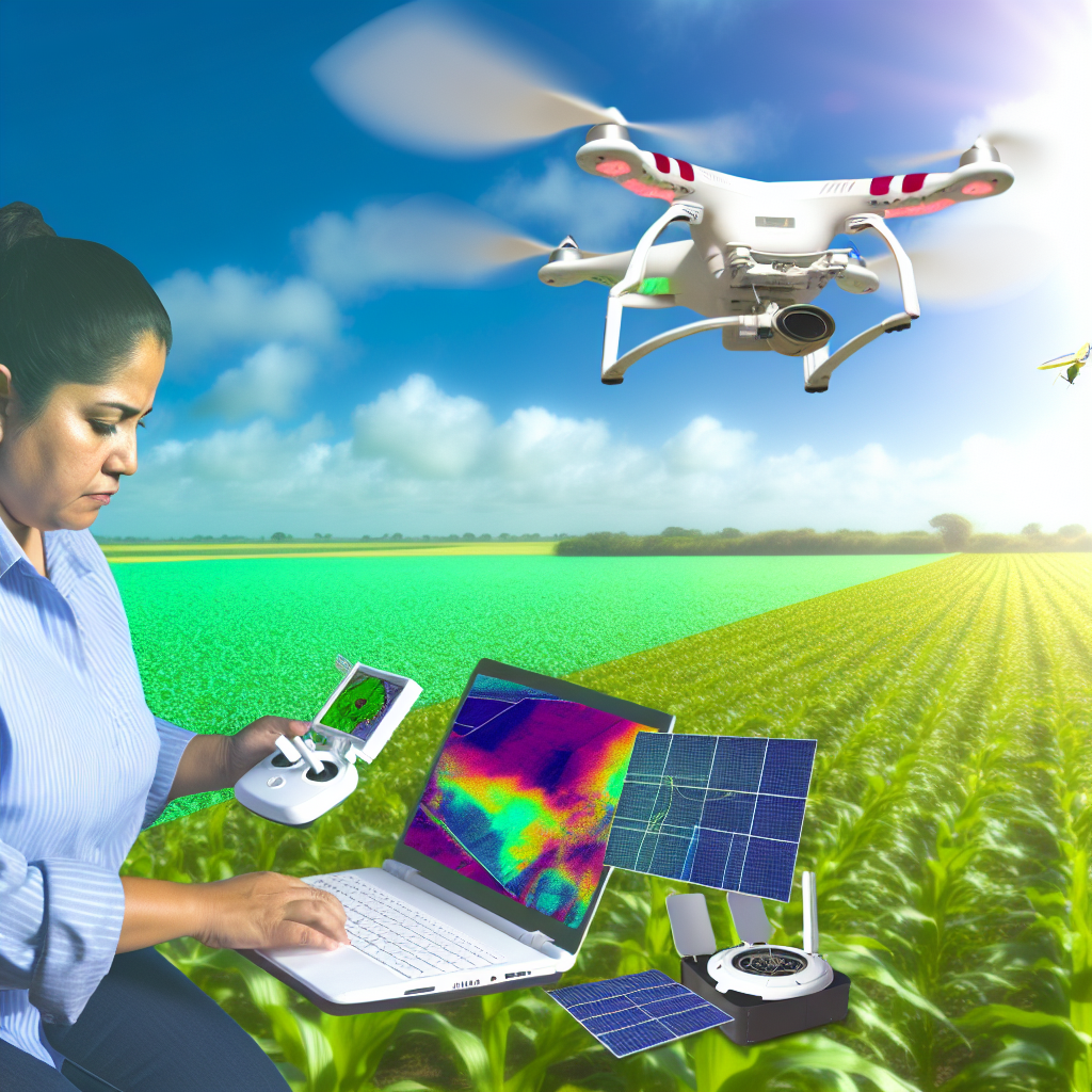
These aerial devices provide high-resolution images of crops.
In one instance, James Turner boosted his corn yield by 15%.
He utilized drones to identify areas lacking nutrients.
As a result, he tailored fertilizer applications precisely.
This increased efficiency lowered costs and enhanced productivity.
Satellite Imagery for Precision Agriculture
Large-scale farms also benefit from satellite imagery.
Global Agri Solutions implemented this technology in California.
Their analysis helped detect water stress in vineyards.
Consequently, managers adjusted irrigation practices effectively.
This strategic decision resulted in a 20% increase in grape quality.
Satellite data also provided forecasts for pest outbreaks.
Remote Sensing for Crop Health Assessment
Remote sensing tools assist in assessing crop health rapidly.
FarmTech Innovations showcased this in Florida’s citrus groves.
By analyzing multispectral images, they identified diseased trees.
This early detection allowed for timely interventions.
As a result, overall orchard health improved significantly.
Farmers reported higher yields and better fruit quality.
Integrating Remote Sensing with Data Analytics
Combining remote sensing with data analytics yields powerful results.
AgroData Solutions partnered with Co-op Farms in Nebraska.
They developed an analytical tool that interprets remote sensing data.
This tool provides farmers with actionable insights.
Farmers can now make informed decisions on crop inputs.
Improvements in yield were measurable across diverse crops.
Challenges and Future Directions
Despite successes, challenges still exist in remote sensing adoption.
Limited internet connectivity affects data transmission.
Moreover, farmers may require training to utilize these technologies.
However, ongoing advancements promise greater accessibility.
Future research will likely improve the accuracy of analytics.
The potential of remote sensing in agriculture remains vast.
Learn More: Data Analytics Tools Every Farmer Should Use
Challenges and Limitations of Using Remote Sensing Tools
Data Accuracy and Reliability
Remote sensing tools rely on accurate data collection.
However, environmental conditions can affect data quality.
For instance, cloud cover can obscure satellite imagery.
Showcase Your Farming Business
Publish your professional farming services profile on our blog for a one-time fee of $200 and reach a dedicated audience of farmers and agribusiness owners.
Publish Your ProfileAdditionally, sensor calibration impacts measurement precision.
Errors in data interpretation can lead to misguided decisions.
Cost Considerations
The implementation of remote sensing tools can be expensive.
Purchasing high-quality sensors requires significant investment.
Moreover, ongoing maintenance can add to overall costs.
Farmers may hesitate to adopt due to these financial barriers.
Technical Expertise Requirement
Effectively using remote sensing tools demands technical skills.
Users need training to interpret data accurately.
Without proper training, even advanced tools may underperform.
This skill gap can deter some potential users from engaging.
Integration with Existing Practices
Integrating remote sensing into current farming practices poses challenges.
Farmers may face difficulty adopting new technologies.
Furthermore, compatibility with existing systems can vary.
Some may resist change due to established routines.
Regulatory Challenges
In some regions, regulations can limit remote sensing applications.
Farmers may struggle to navigate complex legal frameworks.
Compliance with data privacy laws is also crucial.
These barriers might hinder the wider adoption of the technology.
Future Trends in Remote Sensing Technology for Agriculture
Increasing Accessibility of Remote Sensing Tools
Remote sensing tools are becoming more accessible to farmers worldwide.
This accessibility allows small-scale farmers to participate in precision agriculture.
Innovations in smartphone technology facilitate the use of remote sensing applications.
As a result, farmers can monitor crop health more effectively.
Integration of Artificial Intelligence
Artificial intelligence is increasingly integrated with remote sensing technology.
This combination enables more accurate data analysis and decision-making.
AI algorithms predict yields and detect crop diseases early.
Consequently, farmers can take action before problems escalate.
Enhanced Data Analytics Platforms
Data analytics platforms are evolving rapidly.
These platforms process vast amounts of satellite and drone data.
Farmers benefit from actionable insights tailored to their specific environments.
Thus, they can make informed decisions regarding resource allocation.
Adoption of Drones in Agriculture
Drones are becoming essential tools for modern agriculture practices.
They provide high-resolution imagery that reveals crop health variations.
Farmers can conduct aerial surveys to assess field conditions quickly.
Ultimately, drones enhance efficiency in managing agricultural operations.
Real-Time Monitoring Systems
Real-time monitoring systems are on the rise in agriculture.
Farmers can track environmental conditions dynamically.
This capability supports better irrigation and fertilization strategies.
Furthermore, it minimizes waste and maximizes resource use efficiency.
Development of Multi-Spectral and Hyper-Spectral Sensors
Multi-spectral and hyper-spectral sensors are being improved consistently.
These sensors allow for detailed analysis of crop health and soil properties.
Showcase Your Farming Business
Publish your professional farming services profile on our blog for a one-time fee of $200 and reach a dedicated audience of farmers and agribusiness owners.
Publish Your ProfileThey provide information beyond the visible spectrum for deeper insights.
As a result, farmers can optimize interventions and improve yields.
Collaboration Between Tech Companies and Farmers
Collaborations between technology firms and farmers are becoming common.
This partnership fosters the development of customized solutions.
There is a focus on creating platforms that cater to specific agricultural needs.
Such collaborations enhance the overall efficacy of remote sensing technology.
Additional Resources
Application of digital technologies for ensuring agricultural productivity
Revolutionizing Agriculture: How Farmonaut’s GIS and Remote …

