Introduction to Remote Sensing in Agriculture
Remote sensing revolutionizes agricultural practices globally.
Farmers increasingly utilize this technology for efficient resource management.
It integrates satellite and aerial imaging for real-time data collection.
This method provides crucial insights into crop health and soil conditions.
Understanding Remote Sensing Technology
Remote sensing involves collecting data without direct contact.
It uses various sensors to gather information about the Earth’s surface.
These sensors capture reflected or emitted radiation from crops.
Consequently, farmers can monitor changes in vegetation health.
Benefits of Remote Sensing in Agriculture
Farmers enjoy several advantages by adopting remote sensing technology.
- Increased crop yields through accurate field monitoring.
- Efficient use of water and fertilizers, reducing waste.
- Early detection of pests or diseases allows for timely interventions.
Additionally, this technology enhances decision-making processes.
The Role of Data Analysis
Data analysis plays a crucial role in maximizing remote sensing benefits.
Farmers can analyze collected data to identify trends and patterns.
This analysis supports precision farming techniques.
Thus, farmers tailor interventions to specific areas of their fields.
Future Trends in Remote Sensing
The future of remote sensing in agriculture looks promising.
Transform Your Agribusiness
Unlock your farm's potential with expert advice tailored to your needs. Get actionable steps that drive real results.
Get StartedEmerging technologies will further enhance data accuracy.
For instance, developments in drone technology offer greater detail.
Moreover, artificial intelligence will optimize data processing.
Farmers must prepare to adapt to these innovations.
Types of Remote Sensing Technologies Used in Farming
Satellite Imagery
Satellite imagery plays a crucial role in modern agriculture.
This technology captures detailed images of large areas.
Farmers use these images to monitor crop conditions.
Moreover, it helps in assessing soil health.
Satellite data can reveal moisture levels and nutrient deficiencies.
Drones
Drones are becoming increasingly popular in farming.
They provide high-resolution images and real-time data.
Farmers utilize drones to conduct aerial surveys.
These surveys help in detecting pest infestations early.
Additionally, drones can assist in precision spraying of pesticides.
Multispectral Sensors
Multispectral sensors are effective for crop monitoring.
They capture data across different wavelengths.
This data helps identify plant health based on chlorophyll levels.
Farmers can use this information to optimize fertilizer usage.
Furthermore, it allows for targeted irrigation practices.
Infrared Thermography
Infrared thermography detects heat emitted from plants.
This technology helps monitor water stress in crops.
Farmers can adjust irrigation strategies based on data insights.
Additionally, it identifies areas needing immediate attention.
Consequently, it enhances overall crop yield and quality.
Showcase Your Farming Business
Publish your professional farming services profile on our blog for a one-time fee of $200 and reach a dedicated audience of farmers and agribusiness owners.
Publish Your ProfileGround-Based Sensors
Ground-based sensors collect data directly from the soil.
They monitor moisture content and temperature variations.
This information aids in effective water management.
Farmers benefit by using these sensors for precision agriculture.
Thus, they can improve crop productivity sustainably.
Benefits of Remote Sensing for Resource Optimization
Enhanced Crop Monitoring
Remote sensing provides real-time data on crop health.
This technology enables farmers to assess plant vitality effectively.
As a result, timely interventions can enhance yields.
Moreover, it identifies areas needing attention promptly.
Improved Soil Management
With remote sensing, farmers can evaluate soil moisture levels accurately.
This information assists in effective irrigation planning.
Consequently, this leads to reduced water wastage.
Also, farmers can identify nutrient deficiencies in the soil.
Pest and Disease Detection
Remote sensing technologies allow early detection of pests and diseases.
By identifying problem areas quickly, farmers can act swiftly.
This proactive approach minimizes crop losses significantly.
Additionally, it supports the application of targeted treatments.
Resource Allocation
Utilizing remote sensing aids in efficient resource allocation.
Farmers can analyze data to distribute fertilizers and pesticides aptly.
This targeted approach not only saves money but also reduces waste.
Furthermore, it optimizes the use of precious natural resources.
Yield Prediction
Remote sensing contributes to accurate yield predictions.
This helps farmers make informed decisions regarding harvest timing.
Furthermore, it enables better market planning.
Yield predictions enhance financial forecasting for farms.
Delve into the Subject: Automation in Vertical Farming to Boost Productivity
Case Studies of Remote Sensing Applications on Farms
Precision Agriculture in Soybean Farming
A team of agronomists implemented remote sensing technologies in soybean farming.
They used satellite imagery to assess crop health and vigor.
By analyzing these images, they identified areas needing attention.
As a result, farmers optimized their irrigation schedules and fertilizer application.
This led to increased yields and reduced resource waste.
Water Management in Vineyard Practices
A vineyard in California utilized drones for aerial imagery analysis.
These drones monitored vine health and soil moisture levels.
Consequently, vineyard managers adjusted irrigation practices based on real-time data.
This method improved water conservation while maintaining grape quality.
Farmers reported a significant reduction in water usage.
Crop Monitoring in Corn Production
A midwestern farm adopted remote sensing to enhance corn production.
The farm utilized multispectral sensors mounted on UAVs.
These sensors captured critical data on plant health and pest presence.
With this information, farmers made informed decisions for pest control.
Showcase Your Farming Business
Publish your professional farming services profile on our blog for a one-time fee of $200 and reach a dedicated audience of farmers and agribusiness owners.
Publish Your ProfileThis proactive approach reduced pesticide use and boosted productivity.
Yield Prediction and Analysis in Wheat Fields
Researchers implemented remote sensing to predict wheat yields in Kansas.
They analyzed spectral reflectance data to estimate biomass production.
This analysis helped farmers plan for harvest timing and storage needs.
Additionally, accurate yield predictions facilitated better market strategies.
Ultimately, the farm improved its overall profitability.
SoiHealth Assessment Through Thermal Imaging
A farming cooperative used thermal imaging to assess soil health.
This technology revealed soil moisture levels and temperature variations.
Farmers received insights on organic matter and nutrient distribution.
With this information, they implemented targeted soil management practices.
This led to healthier crops and more efficient resource use.
See Related Content: Enhancing Irrigation Efficiency with Remote Sensing
Data Collection and Analysis Techniques in Remote Sensing
Introduction to Remote Sensing
Remote sensing utilizes technology to gather data about the Earth’s surface.
This method aids in monitoring various agricultural aspects effectively.
Moreover, it provides valuable insights for optimizing farm resources.
Data Collection Techniques
Remote sensing employs different techniques for data collection.
Satellite imagery serves as a primary tool in this process.
It captures large-scale data over vast areas.
Aerial photography also plays a crucial role in remote sensing.
Additionally, drones offer precise data collection opportunities.
Types of Sensors Used
Remote sensing utilizes both passive and active sensors.
Passive sensors measure natural radiation reflected from surfaces.
On the other hand, active sensors emit their energy to capture data.
Examples of active sensors include radar and lidar technologies.
Data Analysis Techniques
Data analysis follows the data collection phase in remote sensing.
This stage involves processing the collected data for practical use.
Image processing techniques enhance the quality of satellite imagery.
For instance, algorithms may correct atmospheric distortions.
Geospatial Analysis
Geospatial analysis is vital for interpreting remote sensing data.
It allows farmers to visualize trends and patterns in agricultural data.
Furthermore, it aids in identifying areas that require intervention.
Yield Prediction Models
Farmers can utilize remote sensing data for yield prediction.
These models assess crop health and growth conditions.
Consequently, they help in making informed decisions for resource allocation.
Case Studies of Successful Implementation
Numerous case studies showcase the benefits of remote sensing in agriculture.
For example, farmers in California use drones for precise irrigation management.
This technique significantly improves water conservation efforts.
Similarly, wheat farmers in Australia apply satellite imagery to monitor crop health.
Cost-Effectiveness
Implementing remote sensing techniques enhances cost-effectiveness.
Farmers reduce operational costs while maximizing productivity.
Showcase Your Farming Business
Publish your professional farming services profile on our blog for a one-time fee of $200 and reach a dedicated audience of farmers and agribusiness owners.
Publish Your ProfileFurthermore, these techniques promote sustainable farming practices.
You Might Also Like: Vertical Farming Design Principles for Agricultural Success
Challenges and Limitations of Remote Sensing in Agriculture
Technical Limitations
Remote sensing technologies often require high-resolution imagery.
Low-quality data can impair accurate analysis of crops.
Additionally, adverse weather conditions can obstruct satellite signals.
These issues may lead to incomplete or misleading information.
Data Interpretation Challenges
Interpreting remote sensing data demands advanced analytical skills.
Farmers may lack the necessary training to analyze complex datasets.
This skill gap can hinder effective decision-making processes.
Furthermore, misinterpretation may result in poor resource allocation.
Cost and Accessibility
The initial investment in remote sensing technology can be substantial.
Small-scale farmers may find these costs prohibitive.
Moreover, ongoing operational expenses can strain budgets.
Accessible data and technology remain unequal across different regions.
Integration with Existing Practices
Integrating remote sensing with traditional farming methods can be complex.
Farmers often rely on established practices that may conflict with new data.
Additionally, lack of interoperability with existing systems can arise.
This disconnect may deter farmers from adopting remote sensing technologies.
Regulatory and Privacy Concerns
Remote sensing raises regulatory issues regarding data privacy.
Farmers may be apprehensive about sharing detailed farm data.
Government regulations can restrict access to vital satellite information.
Such constraints can stifle innovation in the agricultural sector.
Gain More Insights: Automated Machinery for Livestock Management
Future Trends in Remote Sensing for Farming
Advancements in Satellite Technology
Satellite technology is rapidly evolving to enhance agricultural monitoring.
New satellites offer higher resolution imagery for precise data collection.
Farmers can detect crop health issues earlier than ever before.
Moreover, improved satellite communication enables real-time data transfer.
Integration with Artificial Intelligence
Artificial Intelligence (AI) is revolutionizing data analysis in farming.
AI algorithms can process vast amounts of data quickly and accurately.
Farmers benefit from predictive analytics for better decision-making.
This integration enhances resource management on farms significantly.
Utilizing Drones for Agriculture
Drones are becoming a common tool in modern agriculture.
They provide aerial imagery that is invaluable for farm assessments.
Drones facilitate crop mapping and environmental monitoring.
Additionally, they can be used for precision application of inputs.
Enhanced Soil and Crop Monitoring
Remote sensing technologies improve soil and crop health assessments.
Sensors can detect nutrient levels and moisture content effectively.
This data helps farmers optimize their inputs for sustainable practices.
Consequently, crop yields can increase while reducing waste.
Improved Decision Support Systems
Decision support systems integrate various data sources for farmers.
Showcase Your Farming Business
Publish your professional farming services profile on our blog for a one-time fee of $200 and reach a dedicated audience of farmers and agribusiness owners.
Publish Your ProfileThis integration provides actionable insights for improved planning.
Farmers can make informed decisions based on up-to-date information.
Furthermore, these systems contribute to better risk management strategies.
Best Practices for Integrating Remote Sensing into Farm Management
Understanding Remote Sensing Technology
Remote sensing technology helps farmers gather valuable data from their fields.
This technology uses satellite and drone imagery to monitor crop health.
Additionally, it analyzes soil conditions and detects water stress.
Farmers should familiarize themselves with the various remote sensing tools.
Identifying Key Indicators for Monitoring
Farmers must determine the key indicators relevant to their operations.
Common indicators include vegetation index, soil moisture, and temperature.
Focusing on these metrics can guide effective decision-making.
Integrating Data into Farm Management Systems
Integrating remote sensing data into existing farm management systems is crucial.
This ensures all data sources are centralized for better analysis.
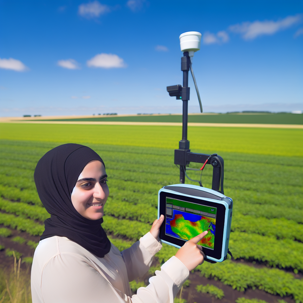
Farmers can leverage software tools to visualize and interpret data efficiently.
This approach enhances precision agriculture practices.
Training and Education for Farmers
Providing training is essential to maximize the benefits of remote sensing.
Farmers should attend workshops on remote sensing applications.
Additionally, online courses can enhance their understanding of this technology.
Collaborating with Agricultural Experts
Collaboration with agronomists and data analysts can improve outcomes.
Experts can help interpret complex remote sensing data effectively.
Engaging with local agricultural extension services can provide valuable resources.
Monitoring and Adjusting Practices Based on Data
Regularly monitoring data allows farmers to adjust practices as needed.
This leads to better crop health and yields over time.
Additionally, it helps in planning future planting seasons more effectively.
Staying Informed on Technological Advancements
Farmers should stay updated on advancements in remote sensing technology.
New tools and techniques frequently emerge to enhance farming efficiency.
Participating in industry conferences can provide insight into these innovations.
Additional Resources
Guo Crop Ecophysiology & Precision Agriculture Lab | Research …

