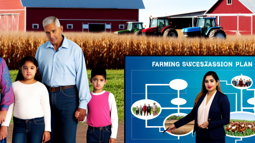
Introduction to GIS Technology in Agriculture
Defining GIS Technology
Geographic Information System (GIS) technology collects and analyzes spatial data.
This technology allows farmers to visualize various factors affecting their land.
Farmers use GIS to make informed decisions about their agricultural practices.
The Role of GIS in Modern Agriculture
GIS plays a critical role in modern agriculture.
Farmers utilize GIS for precise mapping of their fields.
This accuracy helps in resource management and planning.
Ultimately, it increases productivity and reduces waste.
Benefits of Using GIS in Farming
- Improved land use planning enhances productivity.
- Soil analysis assists in targeted fertilization.
- Water management becomes more efficient.
- Pest management strategies become data-driven.
Therefore, GIS not only supports sustainable farming practices.
It also provides farmers with a competitive edge in the market.
Case Studies of Successful GIS Implementation
Agricultural enterprises across the globe have implemented GIS technology.
For example, Greenfields Farms in California uses GIS for crop rotation planning.
This approach has led to a significant reduction in chemical usage.
Moreover, their yield increased due to improved soil health.
Additionally, Bright Land AgriTech employs GIS for efficient irrigation scheduling.
This strategy optimizes water usage and maximizes crop output.
Transform Your Agribusiness
Unlock your farm's potential with expert advice tailored to your needs. Get actionable steps that drive real results.
Get StartedFuture Trends in GIS Technology
The future of GIS in agriculture looks promising.
Innovations in artificial intelligence can enhance data analysis capabilities.
Furthermore, integration with drone technology will provide real-time data collection.
This evolution ensures that farmers remain informed and responsive.
As technology evolves, so will the applications of GIS in agriculture.
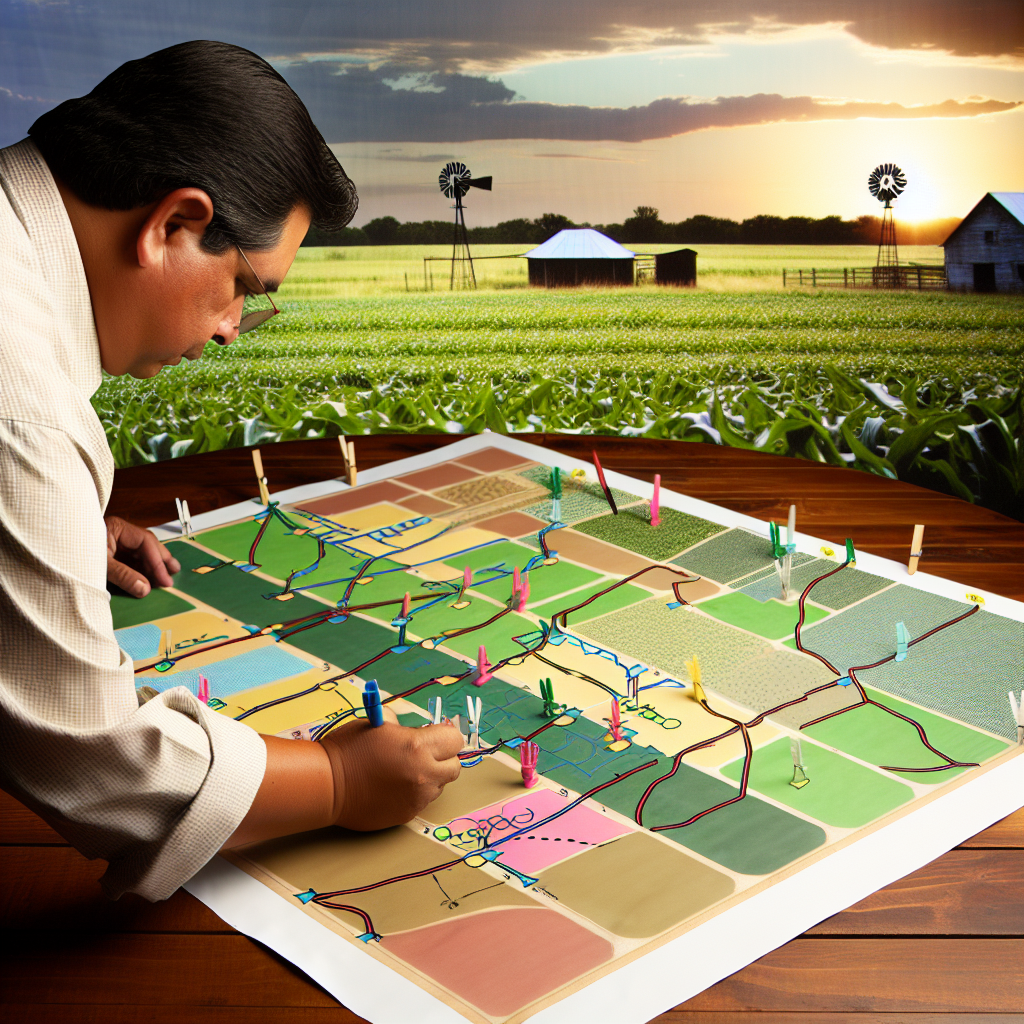
Benefits of GIS Mapping for Farm Planning
Improved Decision-Making
GIS mapping enhances decision-making processes on farms.
This technology allows farmers to visualize data effectively.
Moreover, they can analyze geographical and spatial information.
Consequently, it leads to more informed choices regarding crop selection.
In addition, farmers make better decisions about land usage.
Enhanced Resource Management
GIS mapping optimizes resource management for agriculture.
It helps identify areas needing irrigation or fertilization.
This targeted approach minimizes waste and maximizes output.
Farmers can precisely allocate resources where they’re most needed.
As a result, it leads to more sustainable farming practices.
Improved Crop Yield and Quality
Using GIS mapping can significantly boost crop yield.
Farmers can monitor environmental conditions affecting their fields.
This includes soil quality, moisture levels, and crop health.
Additionally, GIS aids in determining optimal planting strategies.
Ultimately, these factors contribute to higher quality produce.
Time and Cost Efficiency
GIS mapping saves both time and costs in farm operations.
It allows for quicker responses to changing conditions.
Additionally, it reduces the need for manual surveys and assessments.
Farmers benefit from streamlined operations and lower expenses.
Showcase Your Farming Business
Publish your professional farming services profile on our blog for a one-time fee of $200 and reach a dedicated audience of farmers and agribusiness owners.
Publish Your ProfileConsequently, they can focus more on strategic planning.
Risk Management
GIS mapping plays a vital role in managing agricultural risks.
It enables farmers to assess potential threats to their crops.
This includes natural disasters, pests, and diseases.
Moreover, having access to historical data improves risk predictions.
Farmers can implement preventive measures effectively.
Collaboration and Communication
GIS fosters collaboration among agricultural stakeholders.
Farmers can share valuable spatial data with researchers and experts.
This exchange enhances overall agricultural innovation.
Furthermore, it encourages community engagement and support.
In the long run, this collaboration strengthens the agricultural sector.
Key Components of GIS Mapping Systems for Farmers
Data Collection
Data collection forms the foundation of any GIS mapping system.
Farmers gather various types of data, including soil characteristics, weather patterns, and crop yields.
Using sensors and satellite imagery facilitates precise data acquisition.
This data enables farmers to make informed decisions about their land use.
Data Analysis
Data analysis transforms raw information into actionable insights.
Farmers can identify patterns and trends that influence farming practices.
For example, analyzing soil data helps determine the best crops for specific areas.
Additionally, it allows farmers to optimize resource allocation for maximum yield.
Visualization
Visualization is crucial for understanding complex datasets.
GIS mapping tools create clear graphical representations of data.
Farmers can visualize crop health, irrigation needs, and pest infestations.
This clarity enables rapid response to potential issues in the field.
Decision Support Tools
GIS mapping systems often include decision support tools.
These tools help farmers evaluate different farming strategies.
Farmers can simulate various scenarios to see potential outcomes.
Consequently, they can choose the most effective methods for their operations.
Integration with Other Technologies
GIS mapping systems integrate well with other agricultural technologies.
For example, they can work alongside precision farming tools.
This integration enhances efficiency and accuracy in farming operations.
Farmers benefit from a holistic view of their agricultural ecosystem.
Collaboration and Data Sharing
Collaboration among farmers enhances the effectiveness of GIS mapping.
Farmers can share data and insights, fostering community growth.
Data sharing platforms enable access to shared resources and methods.
This collaborative approach strengthens the agricultural network.
Gain More Insights: Effective Collaboration Models For Sustainable Farming
Using GIS for Soil and Crop Management
Importance of Soil Analysis
Sole analysis is crucial for effective farming.
It contributes to understanding soil composition and health.
Farmers can better manage their land using this information.
Furthermore, soil analysis enhances crop yields.
Showcase Your Farming Business
Publish your professional farming services profile on our blog for a one-time fee of $200 and reach a dedicated audience of farmers and agribusiness owners.
Publish Your ProfileHealthy soil leads to healthier plants.
Mapping Soil Properties with GIS
GIS technology allows for detailed mapping of soil properties.
This process identifies variations in soil types across the farm.
Farmers can visualize nutrient distribution through GIS.
Such insights inform targeted soil amendments.
This targeted approach maximizes nutrient utilization.
Crop Rotation Planning
Effective crop rotation is essential for sustainable farming.
GIS assists in planning rotation schedules based on soil needs.
Different crops affect soil health in varying ways.
Farmers can use GIS data to choose the best crop sequences.
This practice prevents soil depletion and promotes diversity.
Assessing Crop Suitability
GIS helps in assessing the suitability of different crops.
Farmers can analyze climate, soil, and topography data.
This analysis guides crop selection for specific areas.
Choosing the right crops increases overall productivity.
Furthermore, it boosts resilience against pests and diseases.
Implementing Precision Agriculture
GIS plays a vital role in precision agriculture.
This approach focuses on maximizing efficiency in farming practices.
Farmers can apply inputs like fertilizers precisely where needed.
This targeted application reduces waste and costs.
Overall, precision agriculture enhances environmental sustainability.
Find Out More: Optimizing Farm Operations Through Strategic Alliances
Integration of Climate Data into GIS for Enhanced Planning
Importance of Climate Data
Climate data plays a crucial role in successful farm planning.
It provides insights into weather patterns and seasonal changes.
Farmers can anticipate conditions and adapt their strategies effectively.
Sources of Climate Data
Various sources provide valuable climate data for farmers.
Government agencies often offer detailed weather reports.
Private meteorological services also deliver specialized forecasts.
Additionally, agricultural universities conduct climate research.
Types of Climate Data
- Temperature records help indicate growing seasons.
- Precipitation data assists in irrigation planning.
- Wind patterns affect crop pollination and yield.
- Humidity levels influence plant health and disease risk.
Integrating Data into GIS
GIS technology enhances the usability of climate data.
It allows farmers to visualize spatial relationships effectively.
Data layers can display weather patterns over specific regions.
By integrating climate data, farm planning becomes more precise.
Tools for Integration
- Geographic Information Systems help in data analysis.
- Remote sensing provides real-time data updates.
- Climate modeling tools simulate future weather scenarios.
Benefits of Enhanced Planning
Integrating climate data into GIS leads to better decision-making.
Farmers can optimize crop selection based on projected conditions.
It helps minimize risks associated with climate variability.
Additionally, it promotes efficient resource management on farms.
Case Studies of Successful Integration
Several farms have experienced significant improvements through this integration.
The Green Valley farm implemented GIS for irrigation management.
As a result, they reduced water usage by 30%.
Showcase Your Farming Business
Publish your professional farming services profile on our blog for a one-time fee of $200 and reach a dedicated audience of farmers and agribusiness owners.
Publish Your ProfileSunny Fields adopted climate data to choose resistant crop varieties.
This approach increased their yield by 25% over five years.
Find Out More: Branding Techniques to Boost Your Farming Business
Case Studies: Successful GIS Implementation in Farming
Introduction to GIS in Agriculture
Geographic Information Systems (GIS) play a crucial role in modern farming.
These tools help farmers visualize, analyze, and interpret data related to their land.
Consequently, GIS enhances decision-making and resource management in agriculture.
Precision Farming at Green Valley Farms
Green Valley Farms adopted GIS technology to improve crop yields.
They utilized satellite imagery to assess field conditions.
This information allowed for targeted planting and fertilization strategies.
As a result, the farm increased its productivity by 20% in one season.
Data Collection and Analysis
Data collection is integral to GIS success.
Green Valley Farms gathered data on soil types, moisture levels, and crop health.
GIS tools facilitated the integration of this data for comprehensive analysis.
Implementation Challenges
Initially, the farm faced several challenges.
Training staff to use GIS technology proved time-consuming.
Furthermore, the cost of the software presented a hurdle.
Despite these obstacles, persistence led to successful integration.
Water Management Strategies at Riverbend Ranch
Riverbend Ranch implemented GIS for efficient water management.
The ranch used GIS mapping to identify irrigation needs across different zones.
This approach minimized water waste while maximizing crop growth.
They reduced water consumption by 30% within the first year.
Monitoring and Maintenance
Regular monitoring is necessary for effective water management.
GIS tools provided real-time data on irrigation system performance.
This information allowed for timely maintenance and adjustments.
Benefits Realized
Riverbend Ranch experienced multiple benefits from their GIS adoption.
These included cost savings and improved crop health.
Farmer engagement and overall efficiency also increased significantly.
Case Study: Sunny Acres Organic Farm
Sunny Acres implemented GIS to boost organic farming efforts.
They focused on optimizing crop rotation and pest management.
GIS tools helped identify pest hotspots and crop compatibility.
This approach minimized chemical inputs and enhanced quality.
Enhancing Crop Rotation Planning
Effective crop rotation is key to sustainable agriculture.
Sunny Acres used GIS to analyze historical yield data.
This analysis supported strategic crop selection for each season.
Combating Pest Issues
Pest management remains a challenge for organic farms.
GIS technology provided insights into pest population trends.
Sunny Acres successfully implemented targeted treatments, reducing overall pesticide use.
Implications of GIS in Agriculture
These case studies highlight the transformative power of GIS in agriculture.
Farmers can leverage technology for improved productivity and sustainability.
As more farms integrate GIS, the agricultural landscape will continually evolve.
Showcase Your Farming Business
Publish your professional farming services profile on our blog for a one-time fee of $200 and reach a dedicated audience of farmers and agribusiness owners.
Publish Your ProfileExplore Further: Competitive Analysis for Agribusiness Success
Challenges and Limitations of GIS in Agriculture
Data Accuracy and Availability
GIS relies heavily on accurate data for effective mapping.
Inadequate data can lead to erroneous analysis and poor decisions.
Moreover, data availability can vary based on location.
This disparity particularly affects farmers in remote areas.
High Implementation Costs
Adopting GIS technology can be expensive for farmers.
Costs include software, equipment, and training expenses.
Many small-scale farmers may struggle to afford these investments.
Consequently, this limits the widespread use of GIS in agriculture.
Technical Expertise Requirement
Effective GIS implementation requires specialized skills.
Farmers often lack the technical knowledge to operate GIS systems.
This creates a barrier to utilizing GIS effectively.
Additionally, ongoing training is essential for optimal use.
Data Overload and Complexity
GIS technology generates vast amounts of data.
Understanding and analyzing this data can overwhelm users.
This complexity can hinder decision-making processes.
Farmers may feel intimidated by the amount of information available.
Integration with Existing Systems
Integrating GIS with existing farm management systems can be challenging.
Compatibility issues may arise, complicating the process.
Furthermore, farmers may face difficulties in data synchronization.
This can lead to inefficiencies in farm operations.
Regulatory and Privacy Concerns
GIS data can raise privacy and regulatory issues.
Farmers must ensure compliance with local regulations.
Failure to adhere to these regulations can result in penalties.
Moreover, data sharing can expose sensitive farm information.
Future Trends in GIS Technology for Sustainable Farming
Integration of Artificial Intelligence
Artificial intelligence will enhance GIS capabilities in farming.
This technology analyzes vast amounts of data efficiently.
Farmers will receive predictive analytics for better decision-making.
AI can identify patterns and anomalies in crop health.
Thus, it reduces the need for manual inspections.
Enhanced Remote Sensing Technologies
Remote sensing will provide real-time data for agricultural lands.
Drones and satellites will capture detailed imagery and data.
This information allows farmers to monitor crop conditions accurately.
As a result, they can respond promptly to various challenges.
Moreover, remote sensing supports precision agriculture techniques.
Improvement in Data Accessibility
Future GIS platforms will prioritize user-friendly interfaces.
This improvement will facilitate easier access to data and tools.
Farmers of all skill levels will benefit from this shift.
Mobile applications will also enhance data access in the field.
Consequently, timely decisions will become the norm.
Showcase Your Farming Business
Publish your professional farming services profile on our blog for a one-time fee of $200 and reach a dedicated audience of farmers and agribusiness owners.
Publish Your ProfileIncreased Focus on Sustainability
Sustainable practices will gain greater emphasis in GIS frameworks.
Farmers will have tools to assess environmental impacts effectively.
Sustainability metrics will integrate seamlessly into farming decisions.
This approach promotes eco-friendly agricultural methods.
Overall, it helps preserve natural resources for future generations.
Collaboration and Data Sharing
Collaboration among farmers will become more common in the future.
GIS technology will enable shared access to data and resources.
This sharing fosters community-driven best practices in farming.
Farmers can learn from each other’s experiences and challenges.
Consequently, teamwork will drive innovation in agricultural practices.