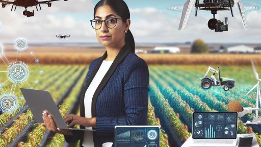
Introduction to Remote Sensing and Precision Agriculture
Remote sensing significantly enhances precision agriculture practices.
This technology allows farmers to gather crucial data about their fields.
By utilizing various sensors, they can monitor crop health and soil conditions.
Remote sensing contributes to informed decision-making on the farm.
Understanding Remote Sensing
Remote sensing involves detecting and interpreting information from a distance.
This technique uses satellites and drones to capture high-resolution images.
Farmers can analyze vegetation indices derived from these images.
Moreover, such analysis reveals the health and growth patterns of crops.
Precision Agriculture Defined
Precision agriculture is a farming management concept that uses information technology.
The aim is to ensure maximum yield while minimizing waste.
Farmers apply inputs such as water and fertilizers precisely where needed.
This method enhances productivity and sustainability.
The Intersection of Remote Sensing and Precision Agriculture
Remote sensing plays a vital role in achieving precision agriculture goals.
It enables real-time monitoring of crop and soil conditions.
Consequently, farmers can respond quickly to emerging issues.
Transform Your Agribusiness
Unlock your farm's potential with expert advice tailored to your needs. Get actionable steps that drive real results.
Get StartedThis integration maximizes resource efficiency and crop yields.
Benefits of Remote Sensing in Agriculture
- Improved crop monitoring through detailed spatial data.
- Timely detection of pest infestations or disease outbreaks.
- Optimized irrigation practices based on soil moisture levels.
- Enhanced yield forecasting leading to better market decisions.
Through these benefits, remote sensing helps farmers make smarter, data-driven choices.
Ultimately, this results in healthier crops and a more sustainable farming future.
Benefits of Remote Sensing in Crop Monitoring
Enhanced Crop Health Assessment
Remote sensing provides accurate crop health data.
Farmers can detect problems quickly using imagery.
This technology helps in identifying pests and diseases early.
In turn, timely intervention can be applied to minimize losses.
Improved Irrigation Management
Remote sensing enhances irrigation practices for farmers.
Satellite imagery offers insights into soil moisture levels.
Farmers can optimize water usage by knowing when to irrigate.
This method conserves water while maintaining crop health.
Precision Fertilization
Remote sensing aids in targeted fertilizer application.
It helps in analyzing nutrient deficiencies within the fields.
Farmers can apply fertilizers only where needed.
This results in cost savings and reduces environmental impact.
Yield Prediction and Monitoring
Accurate yield prediction is possible through remote sensing.
This technology analyzes plant growth patterns efficiently.
Farmers can make informed decisions based on predictions.
As a result, better planning for harvest and sales occurs.
Data-Driven Decision Making
Remote sensing offers valuable data analysis tools.
Farmers can utilize this data for strategic planning.
This leads to improved crop management techniques.
Also, farmers can assess their performances over time.
Cost Efficiency
Implementing remote sensing is cost-effective for farmers.
Showcase Your Farming Business
Publish your professional farming services profile on our blog for a one-time fee of $200 and reach a dedicated audience of farmers and agribusiness owners.
Publish Your ProfileThey can monitor larger areas without labor-intensive methods.
Increased efficiency translates to higher profits overall.
Farmers save time while improving operational effectiveness.
Role of Satellite Imagery in Soil Analysis
Enhancing Soil Mapping
Satellite imagery provides detailed views of the Earth’s surface.
This allows farmers to identify various soil types across their fields.
Moreover, it helps in mapping soil moisture levels effectively.
Farmers can utilize this information to optimize irrigation practices.
Assessing Soil Health
Remote sensing technology aids in evaluating soil health parameters.
It measures variables like organic matter content and nutrient levels.
Consequently, farmers can take informed actions to enrich their soil.
Furthermore, this approach reduces the need for excessive chemical fertilizers.
Monitoring Soil Changes Over Time
Satellite imagery captures changes in soil conditions over time.
Farmers can track erosion, salinity, and compaction issues effectively.
This information empowers them to implement timely corrective measures.
As a result, they can better manage their land for sustainable production.
Facilitating Precision Agriculture Techniques
Satellite data integrates seamlessly with precision agriculture practices.
Farmers can adjust their planting and cultivation strategies accordingly.
This leads to higher yields and better resource management.
Additionally, it ensures a more efficient use of labor and equipment.
Supporting Decision Making
Data gathered from satellite imagery supports decision-making processes.
Farmers can analyze historical trends in soil data to forecast outcomes.
As a result, they can choose the best crops for their specific soils.
This ultimately leads to enhanced productivity and profitability.
You Might Also Like: The Role of AI and Machine Learning in Precision Agriculture
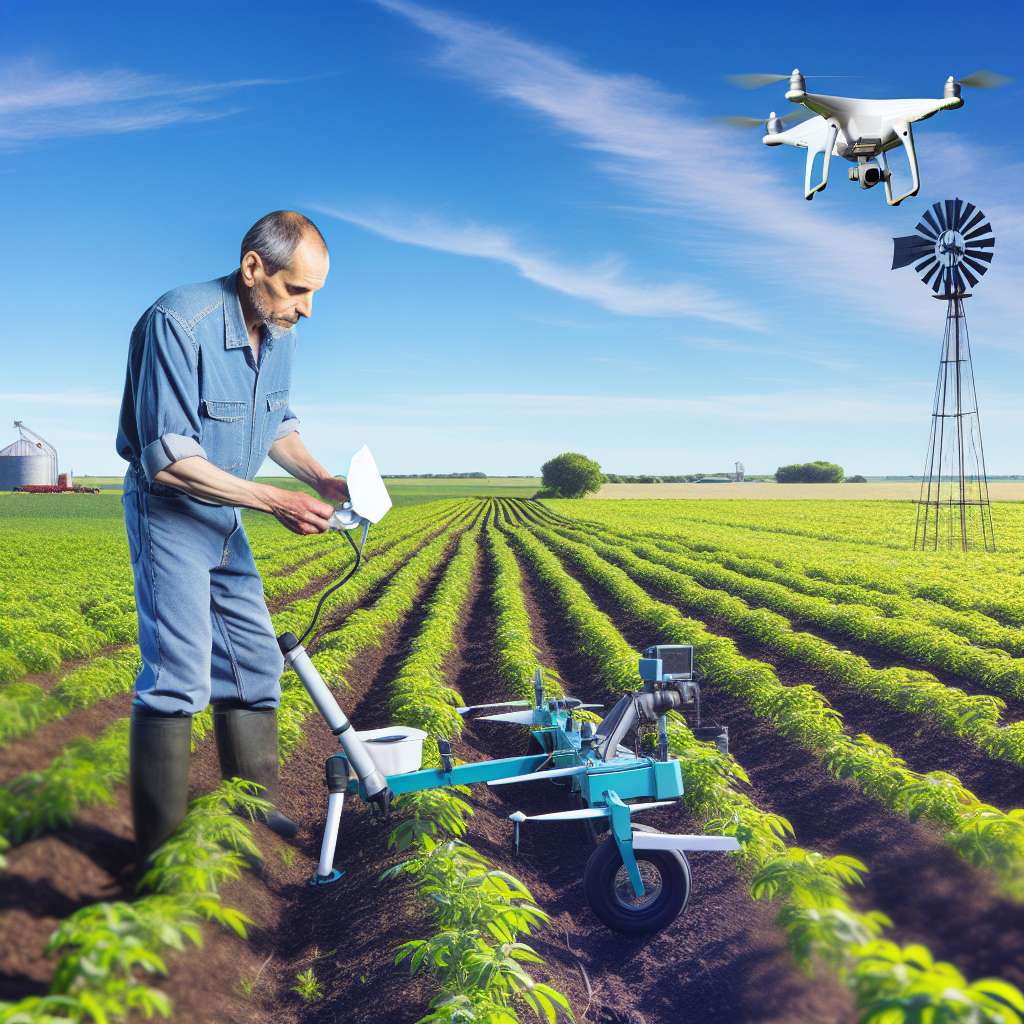
Utilizing Drones for Precision Farming
Introduction to Drones in Agriculture
Drones revolutionize the way farmers monitor their crops.
They provide real-time aerial data to enhance farming practices.
Farmers can analyze their fields quickly and efficiently.
Benefits of Drone Technology
Drones offer numerous advantages for precision farming.
Firstly, they enable detailed crop mapping.
Secondly, they assist in identifying areas needing attention.
Also, they help optimize resource allocation.
For instance, drones can target specific zones for irrigation.
Crop Health Monitoring
Farmers utilize drones for comprehensive crop health assessments.
Drones use multispectral imaging to evaluate plant health.
This technology captures data beyond visible light.
Consequently, farmers receive valuable insights into crop vitality.
Data Collection and Analysis
The data collected by drones is crucial for precision agriculture.
Farmers can analyze this data using specialized software.
This analysis provides insights into yield predictions.
Additionally, it helps farmers make informed decisions.
Showcase Your Farming Business
Publish your professional farming services profile on our blog for a one-time fee of $200 and reach a dedicated audience of farmers and agribusiness owners.
Publish Your ProfileEnvironmental Impact and Sustainability
Drones contribute to sustainable farming practices.
They reduce the need for chemical inputs by targeting specific areas.
This precision minimizes environmental damage effectively.
Moreover, drones can help conserve water through precise irrigation management.
Challenges and Solutions
Despite their benefits, drones face challenges in agriculture.
Regulations limit drone use in certain areas.
Moreover, technical issues may arise, affecting data quality.
Nevertheless, advancements in technology continue to address these issues.
You Might Also Like: Integrating Trees Into Croplands for Sustainable Farming in the USA
Real-time Data Collection and Its Impact on Decision Making
Importance of Real-time Data in Agriculture
Real-time data collection offers farmers immediate insights into their fields.
This technology assesses crop health and soil conditions continuously.
Moreover, it enables swift responses to environmental changes.
Farmers can monitor irrigation levels easily using real-time data.
In addition, this data helps optimize fertilizer use effectively.
Technologies Enabling Real-time Data Collection
Drones have become a crucial tool in modern agriculture.
They can gather high-resolution images of crops rapidly.
Additionally, satellite imagery provides broad coverage for analysis.
Sensor technology also plays a vital role in data collection.
It captures various environmental parameters on-site.
The Role of Data Analytics in Decision Making
Data analytics transforms raw data into actionable insights.
Farmers leverage analytics to understand crop performance better.
This process helps identify areas needing attention quickly.
Predictive analytics allows farmers to plan future actions.
Furthermore, it supports effective resource allocation across fields.
Enhancing Operational Efficiency Through Data Integration
Real-time data integration streamlines farming operations significantly.
It fosters collaboration among various agricultural stakeholders.
Farmers can share data with agronomists for expert advice.
Consequently, this collaboration leads to better-informed decisions.
Efficient operations result in increased yield and profitability.
Discover More: Renewable Resource Utilization for Eco-Friendly Fertilizers
Enhancing Irrigation Practices through Remote Sensing Technology
Understanding Remote Sensing in Agriculture
Remote sensing technology provides valuable insights for modern agriculture.
Farmers utilize satellite images and sensors to monitor crop conditions.
This technology allows for precise data collection regarding soil moisture and crop health.
Benefits of Remote Sensing for Irrigation
Remote sensing improves irrigation efficiency for farmers.
It helps in identifying areas that need water, reducing waste.
Farmers can apply water only where necessary, conserving resources.
Additionally, this technology promotes sustainable farming practices.
Key Applications of Remote Sensing for Irrigation
Crop monitoring is a primary application of remote sensing.
Farmers assess plant health using data from drones or satellites.
This ensures they can address water stress before it impacts yields.
Showcase Your Farming Business
Publish your professional farming services profile on our blog for a one-time fee of $200 and reach a dedicated audience of farmers and agribusiness owners.
Publish Your ProfileAnother vital application is soil moisture mapping.
Advanced sensors measure moisture levels across different fields.
This information guides irrigation decisions, ensuring optimal water application.
Case Studies of Successful Implementation
Many farmers have successfully integrated remote sensing into their irrigation systems.
For instance, Green Valley Farms adopted drone surveillance to monitor crops.
This approach led to a 30% reduction in water usage within a year.
Another example is Blue Sky Agriculture, which utilizes satellite imagery.
They achieved significant water savings while improving crop health and yield.
Challenges and Considerations
Implementing remote sensing does come with challenges.
The initial cost of technology can be high for some farmers.
Additionally, training is needed to analyze and use the data effectively.
Moreover, technological limitations, such as data accuracy, may arise.
Farmers must choose reliable sources and technologies to mitigate these issues.
Future Trends in Remote Sensing and Irrigation
As technology advances, the potential for remote sensing grows.
New developments will enhance data quality and accessibility for farmers.
Integrating artificial intelligence with remote sensing will optimize irrigation further.
Ultimately, remote sensing will play a crucial role in smart farming strategies.
Farmers who adapt will benefit from increased efficiency and sustainability.
See Related Content: The Importance of Soil Mapping in Precision Agriculture Strategies
Challenges and Limitations of Remote Sensing in Agriculture
Data Accuracy Issues
Remote sensing technology often faces challenges related to data accuracy.
Environmental factors can affect the quality of collected data.
For instance, cloud cover can obstruct satellite imagery.
Additionally, atmospheric conditions can distort sensor readings.
High Costs of Technology
Investing in remote sensing equipment can be expensive for farmers.
The initial purchase costs for drones and sensors can be prohibitive.
Moreover, ongoing maintenance and updates also require substantial resources.
Technical Expertise Requirements
Farmers need specialized knowledge to effectively use remote sensing technology.
Understanding sensor data can pose a significant learning curve.
Many farmers may lack the necessary training or support.
Thus, they might struggle to interpret complex data analytics.
Limited Coverage for Small Operations
Remote sensing technologies may not be accessible for small-scale farmers.
These farmers often operate on tighter budgets and have limited land areas.
Consequently, they may not benefit from advanced remote sensing solutions.
Dependence on External Factors
Remote sensing relies heavily on external conditions.
Weather conditions can limit the effectiveness of data acquisition.
Additionally, changes in land use can affect data reliability.
Case Studies: Successful Implementation of Remote Sensing in Farming
Introduction to Case Studies
Remote sensing technology has transformed farming practices globally.
This section explores various successful implementations of this technology.
We will discuss specific case studies highlighting significant benefits.
Case Study: Green Valley Farms
Green Valley Farms, located in California, adopted remote sensing in 2021.
Showcase Your Farming Business
Publish your professional farming services profile on our blog for a one-time fee of $200 and reach a dedicated audience of farmers and agribusiness owners.
Publish Your ProfileThey used drones equipped with multispectral cameras for crop monitoring.
This allowed them to detect plant stress and optimize irrigation practices.
As a result, their water usage decreased by 20% within one year.
Additionally, they achieved a 15% increase in crop yields.
Case Study: River Bend Ranch
River Bend Ranch in Texas implemented satellite imagery for precision agriculture.
The farm analyzed crop health and soil conditions with this technology.
By identifying variations in soil nutrient levels, they tailored fertilization strategies.
This approach led to improved soil health and reduced input costs.
Consequently, the ranch experienced a 10% increase in profitability.
Case Study: Horizon Agriculture
Horizon Agriculture utilized remote sensing to enhance pest management strategies.
Using aerial imagery, they accurately tracked pest populations across fields.
By applying targeted treatments, they minimized pesticide use significantly.
This not only reduced chemical costs but also improved environmental outcomes.
Furthermore, they reported a 12% reduction in total pest damage.
Case Study: Sunny Fields Organic Farm
Sunny Fields Organic Farm focused on precision planting using drone technology.
They implemented seasonal monitoring to adjust planting schedules optimally.
This allowed them to align planting with environmental conditions effectively.
As a result, they achieved higher germination rates and uniform crop growth.
The farm noted an increase of 18% in their overall harvest quality.
Key Takeaways from Case Studies
The successful implementations of remote sensing demonstrate significant advantages.
Farmers benefit from improved resource management and cost savings.
Enhanced crop monitoring leads to higher yields and better quality produce.
Moreover, environmentally-friendly practices foster sustainability in agriculture.
These case studies illustrate the transformative potential of technology.
Additional Resources
Conservation Innovation Grants Awards Fiscal Year 2023 | Natural …
The Environmental Benefits of Precision Agriculture Quantified …