Introduction to Soil Health and its Importance in Agriculture
Soil health plays a crucial role in agricultural productivity.
Healthy soil supports plant growth and enhances crop yields.
Furthermore, it improves water retention and reduces erosion.
Adequate soil health management promotes sustainability.
This leads to healthier ecosystems and biodiversity.
Understanding Soil Health
Soil health refers to the ability of soil to function effectively.
It supports plants, animals, and humans alike.
Healthy soil contains a balanced mix of minerals, organic matter, and living organisms.
Common indicators of soil health include texture, structure, and nutrient availability.
Additionally, microbial activity serves as a vital indicator.
The Role of Soil in Agriculture
Soil is the foundation of agricultural ecosystems.
It provides essential nutrients needed for plant growth.
Furthermore, soil acts as a natural water filter.
It stores water, making it accessible during dry periods.
Healthy soil also mitigates the effects of floods by absorbing excess rainwater.
Transform Your Agribusiness
Unlock your farm's potential with expert advice tailored to your needs. Get actionable steps that drive real results.
Get StartedChallenges to Soil Health
Overuse of chemicals can degrade soil health over time.
Soil erosion poses a significant threat to agricultural sustainability.
Additionally, contamination from pollutants negatively affects soil quality.
Farmers face challenges due to climate change, which alters soil conditions.
Recognizing these threats is vital for improving soil management practices.
Overview of Remote Sensing Technologies for Soil Monitoring
Introduction to Remote Sensing
Remote sensing refers to the acquisition of information from a distance.
It utilizes satellite or aerial imagery to collect data on the Earth’s surface.
This technology plays a crucial role in monitoring soil health.
Types of Remote Sensing Technologies
Various remote sensing technologies exist for soil monitoring.
These include optical, thermal, and microwave sensors.
Each type offers unique advantages for soil analysis.
Optical Remote Sensing
Optical sensors capture visible and near-infrared light.
They help in assessing vegetation cover and soil moisture content.
This type of sensing is widely used in agriculture.
Thermal Remote Sensing
Thermal sensors measure surface temperature variations.
They can indicate moisture stress in soil.
This technology assists in understanding heat patterns and soil health.
Microwave Remote Sensing
Microwave sensing penetrates clouds and vegetation.
It provides insights into soil texture and moisture levels.
Additionally, it is effective in all weather conditions.
Applications of Remote Sensing in Soil Monitoring
Remote sensing plays a vital role in various agricultural applications.
It helps in crop management and predicting soil erosion.
Farmers use this information to make informed decisions.
Soil Moisture Monitoring
Monitoring soil moisture is essential for effective irrigation management.
Showcase Your Farming Business
Publish your professional farming services profile on our blog for a one-time fee of $200 and reach a dedicated audience of farmers and agribusiness owners.
Publish Your ProfileRemote sensing technologies provide real-time moisture data.
This information guides farmers in optimizing water usage.
Assessment of Soil Nutrients
Remote sensing can evaluate soil nutrient levels effectively.
It detects nutrient deficiencies in crops early.
This allows timely intervention and improved crop yields.
Benefits of Remote Sensing for Soil Health
The use of remote sensing enhances soil health management.
It allows for continuous monitoring of soil conditions.
This can improve sustainability in agricultural practices.
Cost-Effectiveness
Implementing remote sensing reduces the need for extensive field surveys.
This leads to significant cost savings for farmers.
Moreover, it offers more accurate data collection over large areas.
Timely Decision-Making
Remote sensing enables timely agricultural interventions.
Farmers can act quickly to changing soil conditions.
This agility enhances overall crop management efficiency.
Types of Remote Sensing Methods Used for Soil Health Assessment
Satellite Imagery
Satellite imagery provides comprehensive coverage of large areas.
It captures data that helps assess vegetation health and moisture levels.
Satellites like Landsat offer multi-spectral imagery.
This data enables analysis of soil moisture and nutrient levels.
Drone-Based Remote Sensing
Drones capture high-resolution images over specific areas.
This method allows for detailed assessments of field variability.
They can use multi-spectral and thermal cameras for analysis.
As a result, drones provide data that enhances soil health monitoring.
LiDAR Technology
LiDAR, or Light Detection and Ranging, uses laser pulses to measure distances.
This technology creates detailed topographical maps.
It helps assess soil erosion and changes in land surface.
LiDAR data is valuable for understanding soil texture and composition.
Ground-Based Sensors
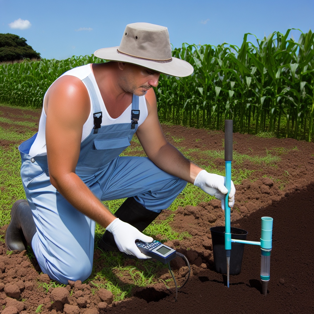
Ground-based sensors monitor soil conditions in real-time.
These sensors measure moisture, temperature, and nutrient levels.
They provide localized data that satellite and drone methods cannot.
Integrating this data improves soil health monitoring accuracy.
Integration of Remote Sensing Data
Combining data from various remote sensing methods creates a comprehensive picture.
This integration enhances the decision-making process for soil management.
Using machine learning algorithms can further optimize data analysis.
Consequently, farmers can make informed decisions to improve soil health.
Discover More: Advanced Technologies Enhancing Vertical Farming Practices
Data Acquisition
Satellites
Satellites play a crucial role in monitoring soil health.
They provide large-scale data over vast areas.
Various sensors equipped on satellites capture different wavelengths.
These wavelengths help in assessing soil moisture and temperature.
For example, the MODIS satellite offers valuable insights into land surface properties.
Showcase Your Farming Business
Publish your professional farming services profile on our blog for a one-time fee of $200 and reach a dedicated audience of farmers and agribusiness owners.
Publish Your ProfileFurthermore, satellite imagery aids in tracking changes over time.
Drones
Drones are increasingly popular for soil health monitoring.
They enable precise data collection at a localized level.
Equipped with high-resolution cameras, drones capture detailed images.
Moreover, multispectral sensors can assess plant health.
Farmers can analyze this data to make informed decisions.
Additionally, drones can cover areas inaccessible to larger crafts.
Ground-Based Sensors
Ground-based sensors provide continuous monitoring of soil health.
They measure parameters like moisture, pH, and nutrient levels.
These sensors often relay real-time data to farmers.
With this information, they can optimize soil management practices.
For instance, IoT-enabled sensors allow remote access to data.
This connectivity enhances the ability to respond quickly to changes.
You Might Also Like: Automated Machinery for Farm Logistics and Supply
Key Soil Health Indicators Monitored via Remote Sensing
Soil Moisture Content
Soil moisture content significantly impacts plant growth and agricultural productivity.
Remote sensing technologies accurately measure moisture levels across vast areas.
This data helps farmers optimize irrigation strategies effectively.
Furthermore, understanding moisture distribution informs drought risk assessments.
Soil Organic Matter
Soil organic matter is crucial for nutrient cycling and soil structure.
Remote sensing can estimate organic matter levels with high precision.
This information aids in assessing soil fertility and long-term health.
Additionally, monitoring organic matter can guide land management practices.
Soil Temperature
Soil temperature affects seed germination and microbial activity.
Remote sensing techniques capture temperature variations across fields easily.
This data can predict plant growth phases and optimize planting schedules.
Moreover, measuring temperature helps identify frost risks for crops.
Vegetation Indices
Vegetation indices provide insights into plant health and vigor.
Remote sensing tools calculate indices like NDVI to monitor vegetation cover.
These indices can indicate stress levels due to soil conditions or pests.
Thus, they enable proactive management of crop health issues.
Soil Erosion
Soil erosion negatively impacts agricultural productivity and ecosystem stability.
Remote sensing detects changes in land cover and soil movement effectively.
This information aids in identifying erosion-prone areas requiring intervention.
Moreover, monitoring erosion supports sustainability efforts in farming.
Nutrient Content
Nutrients like nitrogen and phosphorus are essential for healthy soils.
Remote sensing can help assess nutrient levels and identify deficiencies.
This data informs fertilization practices, reducing waste and runoff.
Thus, remote sensing plays a role in enhancing soil management strategies.
Find Out More: Automated Machinery for Efficient Irrigation Systems
Case Studies: Successful Implementation of Remote Sensing in Soil Health Monitoring
Agricultural Operations in California
In California, remote sensing has transformed soil health monitoring practices.
Showcase Your Farming Business
Publish your professional farming services profile on our blog for a one-time fee of $200 and reach a dedicated audience of farmers and agribusiness owners.
Publish Your ProfileFarmers utilize satellite imagery to assess soil moisture levels effectively.
This technology provides crucial insights into water management strategies.
By analyzing spectral data, they identify nutrient deficiencies promptly.
Consequently, farmers can apply fertilizers more efficiently.
Innovative Practices in Australia
Australia presents another noteworthy case in soil health monitoring.
Farmers combine remote sensing with ground sensors for enhanced results.
This integrated approach tracks soil properties over time.
It allows for real-time adjustments to farming practices.
As a result, they improve crop yields and soil sustainability.
Research Initiatives in Europe
Numerous research initiatives across Europe utilize remote sensing technologies.
Institutions focus on analyzing soil carbon levels remotely.
This analysis supports climate change mitigation strategies.
Additionally, it enhances soil management practices for sustainable agriculture.
Thanks to remote sensing, they can address soil erosion issues more effectively.
Community-Based Projects in Africa
Africa showcases community-based projects using remote sensing in agriculture.
Local farmers work together to monitor soil health collectively.
This collaboration fosters knowledge sharing and resource management.
As a result, food security improves in vulnerable communities.
Remote sensing helps them make informed decisions regarding land use.
Gain More Insights: Automated Machinery for Pest Control Strategies
Challenges and Limitations of Remote Sensing in Soil Health Assessment
Data Quality Issues
Data quality remains a primary challenge in remote sensing for soil health assessment.
Inaccurate sensor readings can lead to misleading conclusions.
Cloud cover and atmospheric conditions often distort measurements.
Moreover, ground truth data is essential for calibration but sometimes lacks availability.
Spatial Resolution Constraints
Remote sensing technology often struggles with spatial resolution limitations.
High-resolution data is essential for localized soil health assessments.
However, many satellite images may not provide the required detail.
This limitation complicates the analysis of small-scale agricultural practices.
Technical Complexity
The technical complexity of remote sensing poses challenges for users.
Interpreting the data requires specialized knowledge and skills.
Many farmers lack access to training in remote sensing technologies.
As a result, they may struggle to utilize the available data effectively.
Cost of Technology
The expense associated with remote sensing technology can be prohibitive.
Many farmers and small agricultural enterprises cannot afford these tools.
This restricts widespread adoption of remote sensing in agricultural practices.
Therefore, more affordable alternatives are necessary for broader participation.
Temporal Limitations
Remote sensing can face temporal limitations in soil monitoring.
Satellite revisits may not align with the agronomic calendar.
Consequently, critical changes in soil health may go undetected.
This gap can hinder timely interventions to improve soil conditions.
Showcase Your Farming Business
Publish your professional farming services profile on our blog for a one-time fee of $200 and reach a dedicated audience of farmers and agribusiness owners.
Publish Your ProfileIntegration with Other Data Sources
Integrating remote sensing data with ground-based observations poses challenges.
Different data formats and collection methods can complicate analysis.
Furthermore, effective communication among stakeholders is vital.
Collaboration between remote sensing experts and agronomists can enhance outcomes.
Future Trends in Remote Sensing Technologies for Agriculture
Emerging Technologies
Innovative remote sensing technologies are rapidly transforming agriculture.
Recent advancements include the use of drones and satellite imagery.
These technologies provide detailed information on soil health.
Moreover, they enable precision farming techniques.
Integration of Artificial Intelligence
Artificial intelligence is increasingly integrated with remote sensing technologies.
This integration allows for predictive analytics in agricultural practices.
Farmers can utilize AI to interpret complex data sets efficiently.
As a result, decision-making becomes more data-driven.
Data Analytics and Visualization
Data analytics tools are crucial for understanding remote sensing information.
Visualization technologies enhance data interpretation capabilities.
Through these tools, farmers gain insights into crop performance.
This knowledge helps in optimizing farming strategies.
Real-Time Monitoring
Real-time monitoring is a significant trend in agriculture.
Farmers can track soil moisture levels as they happen.
This immediate feedback promotes timely interventions.
Consequently, resource management becomes more efficient.
Collaboration with Agriculturalists
Collaboration between technologists and agricultural experts is essential.
Such partnerships foster the development of tailored solutions.
This approach ensures that technology meets specific farming needs.
Future Challenges and Solutions
Despite progress, challenges remain in adopting new technologies.
Cost and accessibility are crucial factors affecting implementation.
In addressing these challenges, educational programs are vital.
Training initiatives can equip farmers with necessary skills.
Additional Resources
Precision Agriculture: Benefits and Challenges for Technology …
FACT SHEET: The Obama Administration Announces New Steps to …

