Introduction to Satellite Imagery in Agriculture
The Role of Satellite Imagery
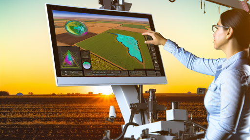
Satellite imagery revolutionizes agricultural practices globally.
Farmers now utilize aerial images for better decision-making.
This technology provides vital information about crop health.
It also helps in monitoring soil moisture levels accurately.
Benefits of Using Satellite Imagery
One major benefit is increased efficiency in resource management.
Farmers can identify areas needing immediate attention.
Consequently, this leads to targeted interventions and cost savings.
Moreover, it enhances crop yield through precise data analysis.
Types of Satellite Imagery
Various types of satellite imagery serve specific agricultural needs.
- Multispectral imagery captures data across different wavelengths.
- Thermal imagery measures crop temperatures effectively.
- Radar imagery assists in monitoring soil conditions.
Applications in Precision Agriculture
Precision agriculture heavily relies on satellite imagery.
This approach optimizes field-level management practices.
Farmers gain insights to apply fertilizers with precision.
Additionally, they can scout for pests and diseases more efficiently.
Future Trends in Satellite Imagery
The future of satellite imagery reveals exciting advancements.
Emerging technologies will improve image resolution further.
Transform Your Agribusiness
Unlock your farm's potential with expert advice tailored to your needs. Get actionable steps that drive real results.
Get StartedAdditionally, real-time data analytics will enhance usability.
Ultimately, these innovations promise to boost agricultural productivity.
Types of Satellite Imagery Used in Agriculture
Optical Imagery
Optical imagery captures visible light and provides clear images of the earth’s surface.
This type of imagery helps farmers assess crop health effectively.
High-resolution optical images allow detailed observations of different crop varieties.
Farmers use these images for precision agriculture to optimize input management.
Multispectral Imagery
Multispectral imagery captures data across multiple wavelengths.
This allows for insights into plant health that are not visible to the naked eye.
Key spectral bands help identify issues such as water stress and nutrient deficiency.
Farmers analyze these images to apply targeted treatments and improve yield.
Hyperspectral Imagery
Hyperspectral imagery provides information from hundreds of spectral bands.
This extensive data enables a deeper analysis of crop conditions.
Farmers utilize this information for advanced monitoring of plant stress levels.
Moreover, it aids in distinguishing among different plant species and varieties.
Radar Imagery
Radar imagery uses microwave radar waves to capture data, regardless of weather conditions.
This aspect makes it particularly useful for monitoring soil moisture levels.
Additionally, radar systems can track crop growth and vegetation cover changes.
This is essential for planning irrigation and understanding crop patterns.
LiDAR Imagery
LiDAR technology uses laser light to measure distances accurately.
It maps terrain and vegetation structure, providing three-dimensional information.
Farmers benefit from this data when planning planting strategies and field layouts.
Furthermore, LiDAR imagery supports erosion management by assessing land topography.
Benefits of Satellite Imagery for Crop Monitoring
Enhanced Data Collection
Satellite imagery allows farmers to collect large amounts of data efficiently.
This data includes detailed information about crop health, soil moisture, and nutrient levels.
Showcase Your Farming Business
Publish your professional farming services profile on our blog for a one-time fee of $200 and reach a dedicated audience of farmers and agribusiness owners.
Publish Your ProfileSubsequently, farmers can make timely decisions that improve yield.
Improved Crop Health Assessment
Understanding crop health is crucial for successful farming.
Satellite imagery provides insights into plant stress early on.
Farmers can identify disease outbreaks and pest infestations quickly.
This proactive approach helps mitigate losses and ensures better quality produce.
Efficient Resource Management
Using satellite imagery helps in optimizing resource use, especially water and fertilizers.
Farmers can apply resources only where they are needed.
This not only saves costs but also promotes environmental sustainability.
Precision Agriculture Implementation
Satellite imagery supports precision agriculture techniques effectively.
Farmers can create variable rate application maps based on precise data analysis.
As a result, this enhances both productivity and ecological sustainability.
Timely Crop Monitoring
Regular monitoring through satellite images keeps farmers informed.
Farmers can track growth stages and identify any issues instantly.
Timely interventions can lead to abundant harvests and improved profits.
Supports Climate Adaptation
Satellites monitor weather patterns and climate changes over time.
Farmers can adjust their practices based on the climate data provided.
This adaptability is essential for surviving in a changing environment.
Delve into the Subject: Remote Sensing Innovations Transforming Agriculture
Application of Satellite Imagery in Precision Farming
Enhancing Crop Monitoring
Satellite imagery provides farmers with detailed images of their fields.
This data allows for better monitoring of crop health and growth stages.
Additionally, farmers can detect areas needing attention quickly.
Consequently, they can implement targeted interventions for better yields.
Optimizing Irrigation Practices
Satellite data aids in efficient water management for crops.
It helps identify dry zones that require additional irrigation.
Moreover, farmers can assess soil moisture levels remotely.
This information helps prevent over-irrigation and saves resources.
Assessing Soil Health
Sensors on satellites monitor soil composition and conditions.
This data helps farmers understand nutrient deficiencies.
Additionally, it allows for evaluating soil erosion and compaction.
As a result, farmers can enhance soil management strategies effectively.
Improving Pest and Disease Management
Satellite imagery plays a critical role in identifying pest infestations.
Farmers can monitor changes in crop color, indicating stress or disease.
By acting quickly, they can minimize crop damage.
This proactive approach leads to healthier plants and higher yields.
Facilitating Yield Prediction
Using historical and current satellite data improves yield predictions.
Farmers can analyze trends and make informed decisions.
Additionally, this practice helps in planning for market demands.
Ultimately, accurate predictions can enhance profitability.
Integrating with Advanced Technologies
Satellite imagery complements other precision farming technologies.
Drones and sensors provide ground-level data for comprehensive analysis.
Showcase Your Farming Business
Publish your professional farming services profile on our blog for a one-time fee of $200 and reach a dedicated audience of farmers and agribusiness owners.
Publish Your ProfileWhen combined, these technologies offer actionable insights.
Farmers can then tailor their practices for optimal results.
Discover More: Optimizing Farm Resources through Remote Sensing
Role of Remote Sensing in Soil Health Assessment
Understanding Soil Health
Soil health directly affects agricultural productivity.
Healthy soil contains essential nutrients for crops.
Additionally, it supports beneficial microorganisms.
Remote sensing helps assess soil health efficiently.
Remote Sensing Technologies
Several technologies aid in soil health assessment.
Satellite imagery provides a broad view of agricultural land.
Drones offer high-resolution images for detailed analysis.
Both methods deliver essential data for farmers.
Evaluation of Soil Properties
Remote sensing evaluates various soil properties.
- It analyzes moisture content across different fields.
- It identifies nutrient deficiencies in crops.
- Additionally, it determines soil texture and composition.
Farmers can develop accurate soil management strategies using this data.
Monitoring Changes Over Time
Remote sensing enables ongoing monitoring of soil health.
Farmers can observe changes and adjust practices accordingly.
This adaptability leads to improved crop yields.
Moreover, it helps in predicting potential soil degradation.
Cost-Effectiveness and Efficiency
Using remote sensing is cost-effective for farmers.
It reduces the need for extensive manual sampling.
Consequently, farmers save time and resources.
The efficiency of data collection enhances decision-making.
Case Studies of Successful Applications
Numerous case studies showcase the benefits of remote sensing.
In the Midwest, farmers improved their yields by monitoring soil moisture.
In California, satellite data helped identify nutrient issues.
Such examples demonstrate the real-world application of remote sensing technologies.
Learn More: Automation in Vertical Farming to Boost Productivity
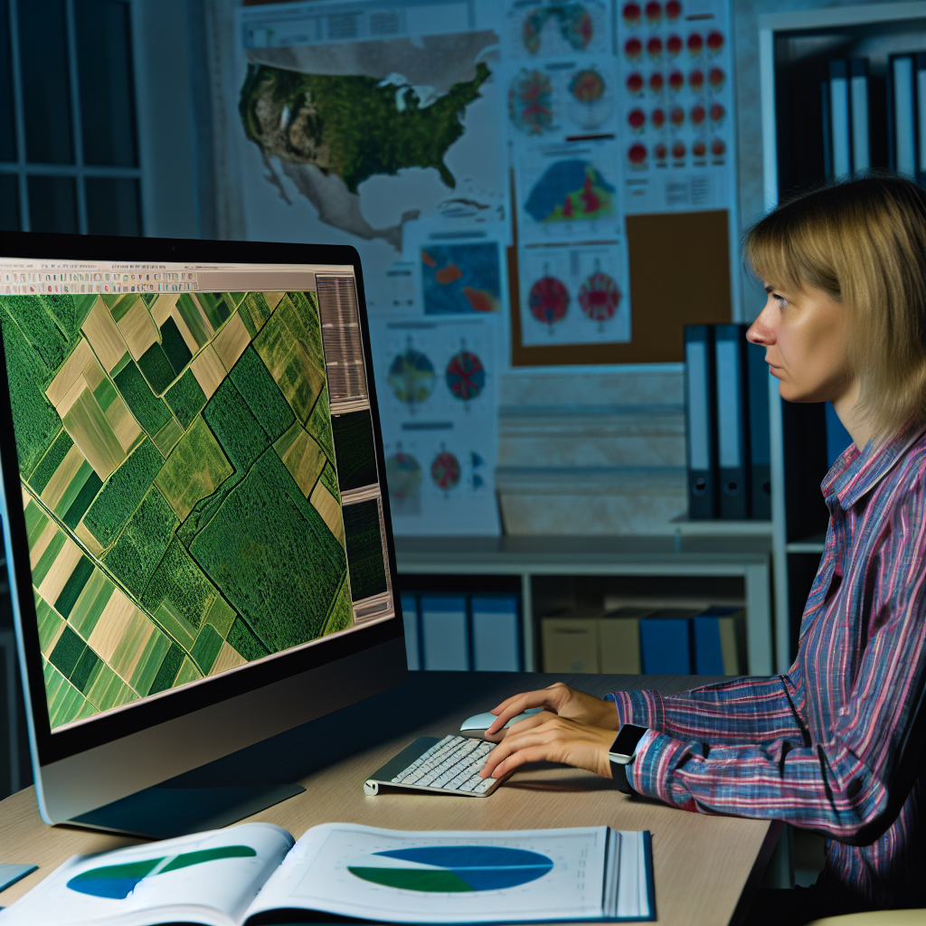
Use of Satellite Data for Pest and Disease Detection
Importance of Early Detection
Early detection of pests and diseases is crucial for crop health.
Timely identification can prevent significant yield losses.
Farmers can make informed decisions based on satellite data.
This proactive approach minimizes the use of pesticides.
How Satellite Imagery Works
Satellite imagery uses advanced technology to capture earth visuals.
It provides data on crop health and soil conditions.
Remote sensing detects color changes linked to plant stress.
This technology allows for large-scale monitoring of farmlands.
Types of Pests and Diseases Identified
Common pests include aphids, beetles, and caterpillars.
Diseases like blight and rust affect crop yield significantly.
Satellite data helps in identifying infestations early.
This enables targeted interventions, reducing crop damage.
Case Studies and Applications
In the Midwest, farmers use satellite data to monitor soybean fields.
Research shows improved yields through timely pest control measures.
Showcase Your Farming Business
Publish your professional farming services profile on our blog for a one-time fee of $200 and reach a dedicated audience of farmers and agribusiness owners.
Publish Your ProfileSimilarly, vineyards in California utilize imagery for disease tracking.
These practical applications showcase the technology’s value.
Future Prospects
The future of satellite data in agriculture looks promising.
Advancements in AI will enhance data analysis capabilities.
This will lead to even quicker response times for farmers.
Increased collaboration among scientists and farmers is vital.
Discover More: Enhancing Irrigation Efficiency with Remote Sensing
Evaluating Crop Yields with Satellite Imagery
Introduction to Satellite Imagery in Agriculture
Satellite imagery revolutionizes the way farmers assess their crops.
This technology provides valuable data efficiently and accurately.
Farmers utilize it to identify crop health and growth patterns.
Moreover, satellite imagery helps optimize farming practices.
How Satellite Imagery Works
Satellites capture high-resolution images of farmland from space.
These images feature a wide range of wavelengths.
Farmers can analyze visible and infrared light to assess crops.
This information reveals key insights into crop health.
Consequently, farmers can detect issues such as pests or diseases.
Benefits of Using Satellite Imagery for Yield Assessment
Utilizing satellite imagery enhances accuracy in yield predictions.
Farmers make more informed decisions based on solid data.
Additionally, this technology helps in efficient resource allocation.
For instance, farmers can optimize water usage and fertilizers.
Furthermore, it reduces operational costs significantly.
Case Studies of Successful Implementation
Numerous agricultural companies successfully leverage satellite imagery.
A prominent example is AgriTech Innovations, which increased yields dramatically.
They adopted satellite monitoring for all their farms in 2021.
As a result, they achieved a 15% increase in crop yields within a year.
Another case is GreenFields Farms, which reduced water usage significantly.
Through satellite data, they managed to cut costs by 20%.
Challenges and Limitations
Despite numerous benefits, challenges exist in using satellite imagery.
Data interpretation can be complex and requires expertise.
Moreover, initial costs for technology can be high for small farmers.
Additionally, weather conditions can affect image quality and availability.
Future Trends in Satellite Imagery for Agriculture
The future of satellite imagery in agriculture looks promising.
Emerging technologies will enhance data accuracy and usability.
Furthermore, advancements in machine learning will streamline data analysis.
Farmers are likely to see improved accessibility to satellite services.
Consequently, more farms will benefit from this powerful tool.
Case Studies of Successful Satellite Imagery Implementation in Agriculture
Precision Farming with Aerial Imagery
Agriculture Innovations Inc. enhanced crop yields through satellite imagery.
The company utilized high-resolution aerial images to monitor plant health.
This technique enabled targeted interventions and resource optimization.
As a result, farmers reported up to 30% increased yields in affected areas.
Showcase Your Farming Business
Publish your professional farming services profile on our blog for a one-time fee of $200 and reach a dedicated audience of farmers and agribusiness owners.
Publish Your ProfileWater Management Solutions
Green Grass Farms employed satellite data for irrigation management.
They analyzed soil moisture levels and vegetation stress from orbiting satellites.
This approach helped them reduce water consumption considerably.
Farmers saved an estimated 25% on water usage, which is sustainable and efficient.
Pest Detection and Control
Harvest Solutions utilized satellite imagery to detect pest outbreaks early.
Through spectral analysis, they identified infested areas promptly.
This proactive measure allowed for quick pesticide application, minimizing crop loss.
Crops remained healthy, leading to more profitable harvests for farmers.
Weather Impact Monitoring
Sunrise Agriculture used satellites to predict weather-related risks.
Their advanced models assessed potential impacts on growing seasons.
Farmers received timely information that influenced planting and harvesting decisions.
Consequently, they mitigated risks associated with adverse weather conditions.
Crop Mapping
Field Mapping Co. created detailed crop maps using satellite imagery.
Farmers gained insights into crop variety distribution and health status.
These maps guided crop rotation and fertilization strategies.
As a result, farmers improved soil health and crop productivity significantly.
Long-Term Sustainability
Many farms now leverage satellite imagery for sustainable practices.
Data-driven decisions lead to a reduction in unnecessary chemical use.
Farmers benefit from increased efficiency and reduced environmental impact.
This fosters a healthier ecosystem and promotes sustainable agriculture.
Additional Resources
Data and Statistics – USDA – National Agricultural Statistics Service

